
Aloft
Challenge to design an elevated neighbourhood
Overview
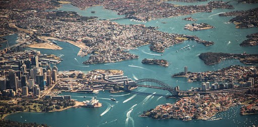 Fig: 1 - Infrastructure and built environment is overwhelming cities in a linear manner.
PREMISE
The planet Earth is characterised by its resources of land, water and atmosphere. Civilisations emerged from these habitats and found shelter. Land is the base of human civilization as it presents the ideal context for settlement. In the 21st century, humans started to realise that the abundance of land resources is unable to keep up with its growing demand.
Since the demand is constantly increasing with time, the solution of skyscrapers was presented which capitalised on the ability of land by building a superstructure to support larger populations. But even this has not proved enough to satiate the needs and demands of the masses. The world we create on urban land is versatile and extensive, from housing to commerce to leisure. As the list of spaces goes on, more and more land is scavenged for building.
In this process, what becomes of the land and its quality, is often ignored. The limited reserves of this resource make its conscientious use vital and complex. How can this one-sided mentality be changed, in the pressing circumstances of society?
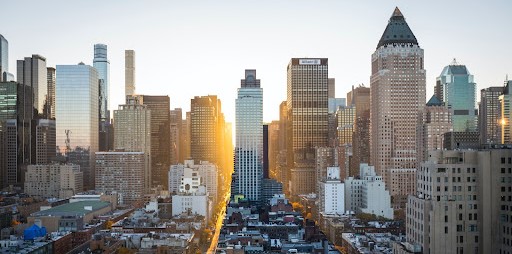 Fig: 2- Urbanisation is growing cities into bigger agglomerations with no space left for green respite.
ISSUE
Urban cities are centres for social, political and cultural activities which enrich the lives of their inhabitants. Land is cleared to accommodate these spaces majorly, and the quality of the environment may degrade in the process. Our fundamental thinking about land use must change.
Land property is often valued in a two-dimensional manner. The ownership of any piece of land is fixed and anything that is built on it is owned by that entity. But since all of our building activity has led to deterioration of its quality, there is a need to search for an alternative to constructing on land.
Can we search for new ways to get maximum use from land without compromising its value? Can we look at the property in a city in a three-dimensional sense? Can one piece of property be owned by multiple owners, in a vertical sense? How can we combat the issues of Urban Heat Island (UHI) and climate change in cities, in a larger picture?
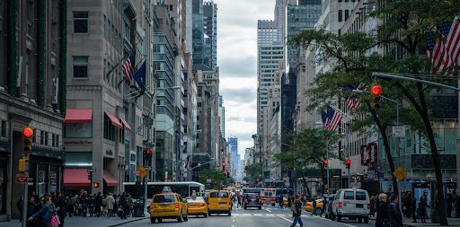 Fig: 3 - Unconventional solutions must be proposed to alleviate the stress on land resources.
BRIEF OF THE COMPETITION
The challenge is to design an elevated neighbourhood that is raised from the ground at a certain height.
The ground/land can be used for urban farming and the complex above will create a self-sufficient neighbourhood.
Housing being the primary function of the complex, it is also to host public spaces like restaurants, gardens, and a learning centre on farming education. Design of the neighbourhood must respond appropriately to the available resources and conditions of the site. The design must be suitable for everyday use and not dominate with its aesthetic.
The aim of the design is to explore a new way to analyse land value in an urban setting. The building above the land can protect the area below from heat, with shade and thermal comfort. By adding a new dimension to be used, the balance of innovation with convenience is key. The elevated structure must work in harmony with its on-ground counterpart.
OBJECTIVES
- Accessibility: The floating complex will require a solution for the accessibility and navigation layout that must be designed horizontally and vertically.
- Resilience: The complex must be built as per the unique challenges it might face structurally due to its elevated nature.
- Safety: The increased height calls for safety measures employed in public spaces and open areas.
- Balance: Privacy and interaction must be guided in the layout as per nature of activity. The aesthetics and functionality must be balanced to create a mix of open, semi-open and closed spaces.
- Context: The site surrounding will play a major role in design and the complex will also have a vice versa effect on the site, which must be addressed.
PORTLAND, OREGON
Portland is a port city, known for its vibrant cultural scene. The ‘city of roses’ is characterised by pleasant weather, while being an earthquake-prone area. The rapid development of urban areas has increased the urban heat island effect in the city. Despite changes in climate, it remains an ideal location for urban farming.
Urban agriculture has found a strong foothold in the city. Supplemental business have also boomed in the last decade. While local farms outside the city provide a food economy, regulations are in place to encourage farmer’s markets and community gardens in the city.
SITE
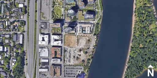
The site is in the neighbourhood of the South Waterfront of South Portland. It can be accessed by Lane street and Bond avenue and is located beside the Willamette River. The land around the site is used for on-ground parking. The neighbourhood is mixed-use with high-rise residential, commercial (retail) buildings, dining outlets and parks in the vicinity.
- Site area = 7878.83 sq.m
- Height restriction of the total intervention = 20 m
- Minimum raised height from the ground = 5 m
- Maximum raised height from the ground = Upto the designer
- Maximum FAR = 1
- Ground coverage = 50%
- Coordinates = 45°29'43.3"N 122°40'09.1"W
Setbacks (as per CAD plan)
Ground Coverage refers to the ratio of the maximum allowed solid/permanent footprint on the site to balance the built and unbuilt spaces. You can utilize the other 50% of the site for any temporary intervention/recreation.
PROGRAMMATIC OUTLINE
This programmatic outline is the point to begin your design at. You can add more functions and activities in relevance or modify the below design programme.
Spaces to live 40%: a total of 60 dwelling units of 50 sq.m each
Spaces for leisure 15%: clubhouse, exhibition hall for gathering, restaurants, terraces, gardens
Spaces to learn 20%: studios, workshops, multimedia room
Spaces to work 25%: Retail, Workshops, Farming
Similar Competitions
Discover competitions you might be interested in


Challenge to design mud housing for contemporary communities


The Global Benchmark for Architecture Dissertation Awards
