
Median
Challenge to design an Emergency operations center
Overview
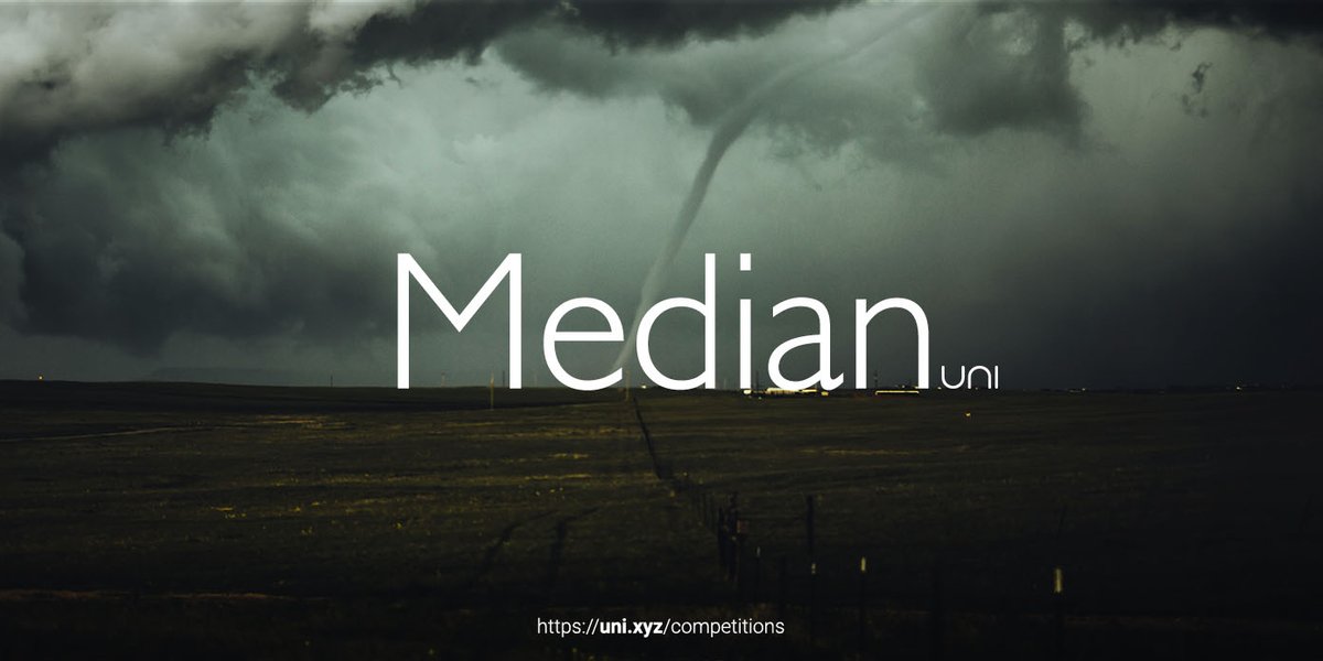
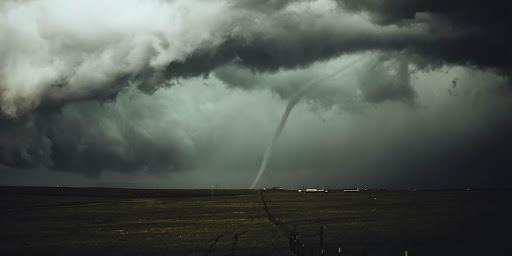 Fig: 1 – Twister in Tornado Alley (Credits-Nicholas Noonan)
PREMISE
Disasters are serious disruptions occurring over a short or long period that causes widespread human, material, and economic or environmental loss which exceeds the ability of the affected community or society to cope using its resources.
They can be divided into natural or man-made, although some fall into a complex category, where there is no specific root cause to it. For instance, a tsunami is triggered by shifting plates, resulting in coastal flooding. The impact and losses due to flooding thus depend on the amount of human intervention in both a positive and negative light. The world has witnessed a tenfold increase in the number of natural disasters since the 1960s.
There is no denying that due to climate change and in turn warming of global temperatures has increased the likelihood and impact of natural disasters year by year. Since core climate change requires a lot of problem-solving on a macro and micro scale.
As designers, can we begin to accommodate, mitigate and plan for the future through responsive design solutions?
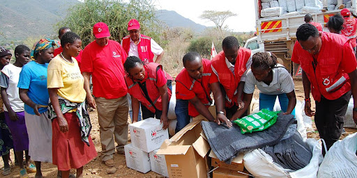 Fig: 2 – Emergency food distribution Somalia (Credits- IFRC)
EMERGENCIES
In the last decade, more than 2.6 billion people have been affected by natural phenomena such as earthquakes, tsunamis, landslides, cyclones, heat waves, floods, or severely cold weather. Disasters severely affect regions with higher population numbers and damage infrastructure and living.
These disasters lead to mass casualty not only in deaths but also in architecture, culture and communities in the form of living, cultural heritages and physical, and mental traumas. An immediate disaster can overwhelm local resources and infrastructure to prevent and manage such consequences.
Although disaster sensing and monitoring technologies can now predict the regions and belts where the disasters would possibly occur, there is better preparedness during emergencies through international and national help.
However, as the damage is fast, the deployment of resources needs to have an equal response. Can we by creating a resilient centralized system help in doing so?
Through a physically efficient and resilient structural framework, can we help in the improvement of response systems and in turn mitigate the effects of future disasters?
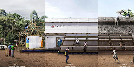 Fig: 3 –-Emergency Operations Centre-Sub Saharan Africa-Concept (Credits- Winner of Kaira Looro competition)
BRIEF OF THE COMPETITION
Emergencies strike suddenly and without warning. They put everything from villages to cities to the ground and tear down their identities In recent years the occurrence of disasters increased dramatically. While design for natural disasters comprises research and design solutions for housing, the structure/ framework for managing resources, distribution and other emergencies services during the time of crisis is often left out of spatial designs.
Through this competition can we streamline the need to design for emergencies? Resolving an emergency of any kind requires more than just the distribution of essentials, it becomes the nervous system of re-establishing order in the area.
Policies, leadership and volunteering efficiently do so, but can we support them physically and establish a sense of peace and security?
Design an Emergency operations center that can help to provide basic services and security to the affected region.
It will house humanitarian operations of organisations, allowing them to act with efficiency. The centre also aims to act as a robust structure for the community before, during and after the disaster.
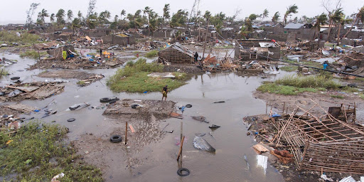 Fig: 4 – Mozambique struck by cyclone Idai (Credits- Denis Onyodi: IFRC/DRK/Climate Center)
MOZAMBIQUE
Mozambique is located on the southeast coast of Africa. It is a country that is prone to natural disasters, having experienced 46 cyclones and floods in the past 30 years.
The frequent occurrence of natural disasters such as floods, cyclones, drought and earthquakes has had a significant impact on people and the economy. It is estimated that as much as 25 percent of the population faces a high mortality risk from such events, and the country ranks as the second most geographically exposed country in Africa.
Due to multiple hazards in recent years, national and international organizations like the UN and SADC have for years stressed the need to improve climate resilience as well as preparedness against natural disasters in severely affected regions of Africa.
On this account, the authorities endorsed the offer to host the SADC Humanitarian and Emergency Operations Centre in Mozambique(SHOC) on 1st April 2021.
OBJECTIVES
- Robust: Ideate technologies and techniques to design a durable solution that can experience the effects of earthquakes and cyclones while retaining functions and structure.
- Users: Design for the community as well as the staff of humanitarian organizations.
- Functions: Other than providing shelter and space for operations, how can architecture help prepare for a disaster?
The objectives can be a point of beginning to conceive this design. Participants are free to form their programmatic outline according to the user group.
PROGRAMMATIC OUTLINE
- Emergency Operations 50%
Operations office, Meeting room, Assistance room/office, Emergency relief (food, water, shelter), Infirmaries and first Aid, Public/Field area
- Community 25%
Workshops/learning areas, gathering spaces
- Services 25%
Toilets/washrooms, Cafeterias, Kitchen, Storage, Security, Maintenance
SITE
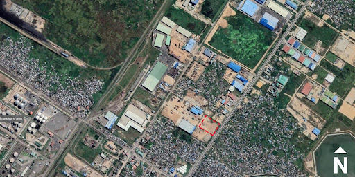
Beira, Mozambique
Beira is the fourth largest city in Mozambique. It was the epicenter of cyclone Idai that hit in 2019 and suffered huge infrastructural and economic damages of 1 billion dollars. Severe damage has been done to schools, hospitals, health facilities and other key infrastructure.
These consequences are estimated to take years to recover through long-term efforts through emergency response and prevention of further damage by the disaster. The site is located in between habitation and will act as a median between community and future disasters.
- Coordinates: -19.8054198 34.8621356
- Site Area: 17,132.71 sqm
- Maximum FAR: 1
- Height Restriction: 6m
- Ground Coverage: 50%
Setbacks (as per CAD plan)
Ground Coverage refers to the ratio of maximum allowed solid/permanent footprint on the site to balance the built and unbuilt spaces. You can utilize the other 50% of the site for any temporary intervention/recreation.
Similar Competitions
Discover competitions you might be interested in


Design challenge to reuse E-waste


Imagining parliament for an unified world.


Design challenge fostering public involvement in wildlife research

Design an urban fitness centre
