
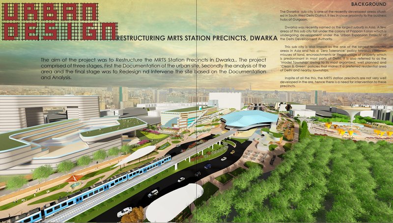
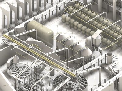
Restructuring Dwarka MRTS Station Precincts: Urban Design for Public Good
Reimagining Dwarka’s MRTS corridor through people-centric transit-oriented urban design that transforms infrastructure into inclusive public life.
Restructuring Dwarka MRTS Station Precincts - Urban Design for Public Good is an urban design proposal that addresses the underutilized and fragmented environments surrounding metro infrastructure in Dwarka, New Delhi. Conceived as a people-first intervention, the project explores how transit-oriented urban design can transform MRTS station precincts into active, inclusive, and legible public realms that connect movement, place, and everyday life.
Rather than treating metro stations as isolated transport nodes, the project reframes them as catalysts for urban vitality: spaces where mobility, commerce, recreation, and community intersect.
Project by Sahil Harjai
Context and Background
Dwarka Sub City, located in South West Delhi, is one of the largest planned residential developments in Asia. Designed under the Delhi Development Authority’s urban expansion initiatives, Dwarka follows a structured grid, wide roads, and zoned land-use planning. Despite these strengths, the MRTS station precincts remain poorly developed, characterized by vacant plots, weak pedestrian connectivity, informal activities, and vehicular dominance.
The disconnect between large-scale planning and ground-level experience has resulted in residual spaces around metro corridors, spaces that are used but not designed. This project identifies these gaps as opportunities for meaningful urban intervention.
Design Aim and Methodology
The primary aim of the project is to restructure MRTS station precincts by strengthening the relationship between people, movement, public space, and built form. The design process was carried out in three clear stages:
- Documentation – Mapping existing physical, social, and infrastructural conditions across the MRTS corridor.
- Urban Analysis – Studying land use, accessibility, vegetation, activity patterns, footfall variations, and conflict zones.
- Design Intervention – Proposing spatial, programmatic, and architectural strategies to activate the precinct.
This layered approach ensures that the final design emerges directly from on-ground realities rather than imposed formal gestures.
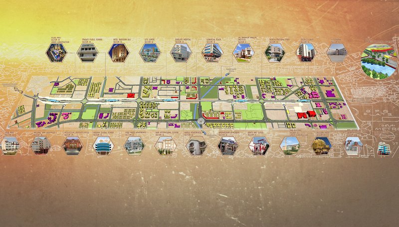
Urban Analysis and Key Observations
Detailed mapping revealed a corridor dominated by vehicular infrastructure, with pedestrians navigating unsafe crossings, inactive edges, and disconnected plots. Large tracts of vacant land coexist with intense informal activity, while green spaces remain fragmented and inaccessible.
Footfall studies highlighted strong temporal variations: peak activity during office hours, school dispersals, and evening hours, indicating the need for flexible, multi-use public spaces. The absence of a distinct urban character further weakens the identity of the MRTS precincts.
Design Philosophy: People Before Traffic
At the core of the proposal lies an unconventional yet essential shift, designing the city from eye level. Instead of prioritizing vehicular efficiency, the project emphasizes walkability, sensory experience, and social interaction. Walking speed, viewing angles, sound, texture, and spatial proportions inform every design decision.
This people-centric philosophy aligns with principles of transit-oriented urban design, where accessibility, density, mixed-use programming, and public life reinforce one another.
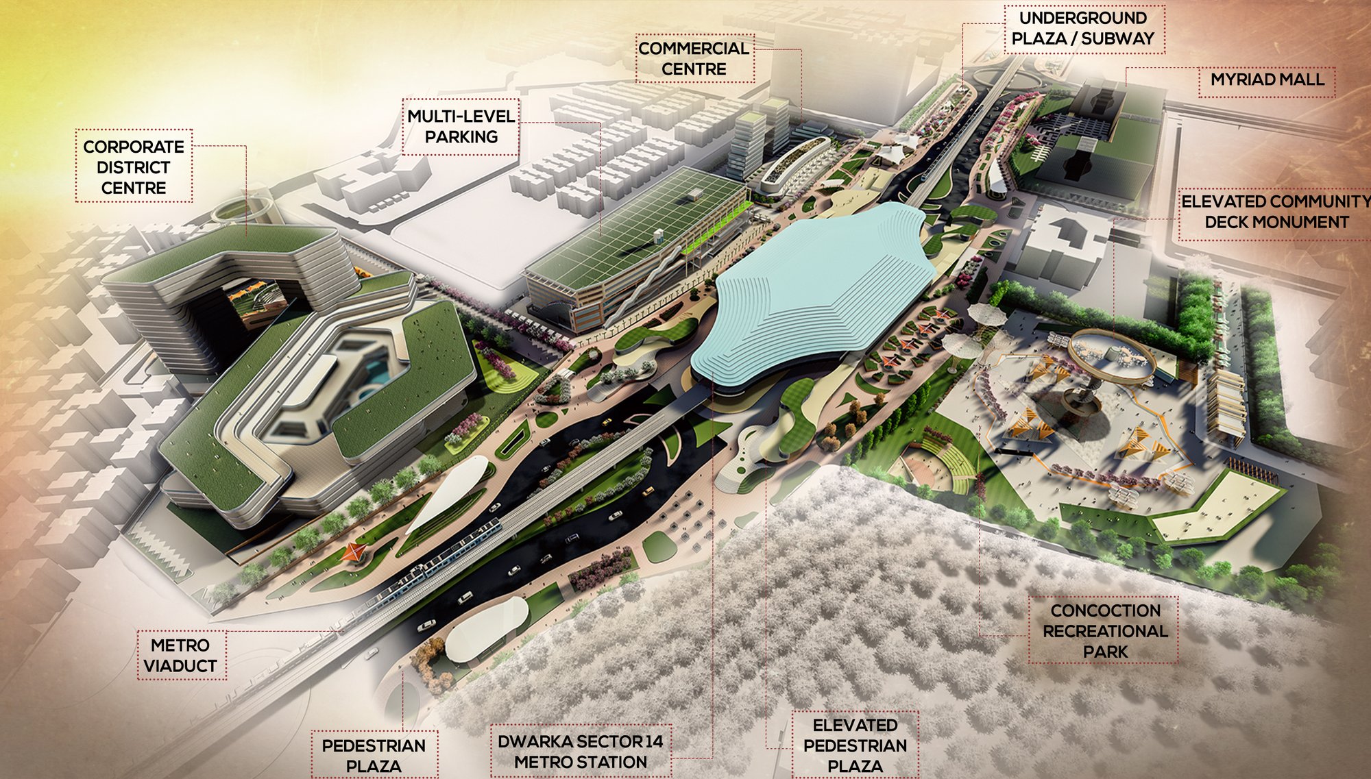
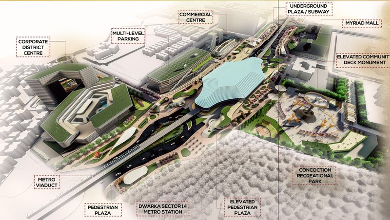
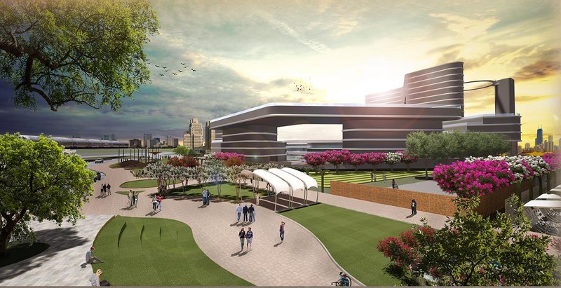
Gateway to Dwarka
The MRTS station precinct is reimagined as a symbolic and functional gateway to Dwarka. The proposal introduces a layered public realm that integrates:
- Pedestrian plazas at grade
- Elevated community decks
- Underground plazas and subways
- Recreational parks and green corridors
These elements stitch together previously disconnected zones, transforming the corridor into a continuous civic landscape.
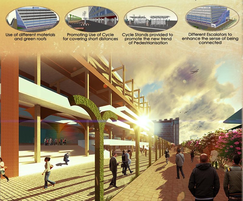
Key Urban Design Interventions
The project proposes a comprehensive set of interventions across the corridor:
- Pedestrian-first plazas and promenades
- Multi-level parking integrated with public space
- Commercial and mixed-use hubs near transit nodes
- Continuous cycle lanes and pedestrian networks
- Green buffers, shaded walkways, and urban vegetation
- Subway systems activated through light, art, and informal commerce
Buildings are positioned as “activity magnets,” encouraging movement and interaction rather than acting as isolated objects.
Commercial and Community Integration
Strategically placed commercial centers, district hubs, and recreational parks act as anchors along the MRTS corridor. By blending retail, offices, libraries, cultural spaces, and open grounds, the proposal ensures that the precinct remains active throughout the day.
This integration supports economic activity while reinforcing the social role of public space, an essential component of sustainable urban development.
Walkability as Urban Infrastructure
Walkability is treated not as an afterthought but as critical urban infrastructure. Design decisions are informed by human movement patterns, visual comfort, and accessibility. Elevated walkways, safe crossings, and continuous pedestrian routes ensure seamless movement across complex traffic zones.
Restructuring Dwarka MRTS Station Precincts demonstrates how transit-oriented urban design can unlock the latent potential of infrastructure-led development. By transforming metro station precincts into vibrant public spaces, the project repositions transit corridors as civic assets rather than barriers.
Rooted in analysis, guided by human experience, and driven by public good, the proposal offers a replicable framework for reimagining metro cities across India and beyond.


Popular Articles
Popular articles from the community
Guangzhou's Twin Towers Interiors Move Like Water
DuShe Architectural Design shapes the lobbies of a massive Guangzhou transit hub with undulating ceilings and deep geological materiality.
Bood Design Bureau Splits a Gilan Residence in Two to Let the Forest In
Double Side House negotiates privacy and openness through interlocking concrete volumes and planted courtyards in northern Iran's humid Caspian lowlands.
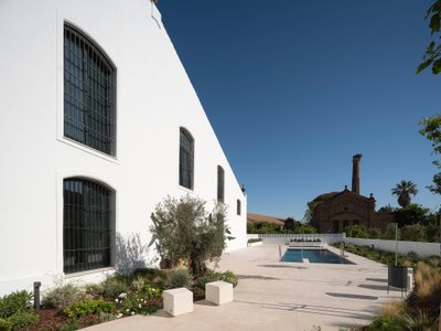
De la Riva Sherry Homes By Juan Vega Arquitectos
De la Riva Sherry Homes transform a historic winery into unique residences, blending industrial heritage, modern comfort, and community-focused courtyard living.
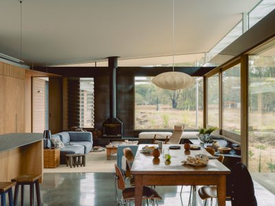
Not All Architecture Grounds a Timber Retreat in Victoria's Coastal Bushland
Ironbark House stretches low beneath eucalyptus canopy, threading a quiet domestic life between courtyard, deck, and landscape.


Similar Reads
You might also enjoy these articles
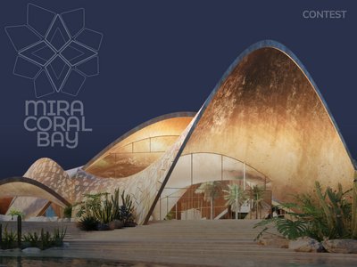
Architectural Competition: Create a Luxury Waterfront Community in the UAE!
Mira Developments announces an open competition for the pre-concept design of Mira Coral Bay in Ras Al Khaimah, UAE
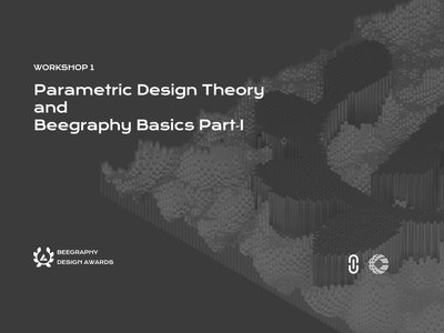
Parametric Design: What Can You Learn from the 1st Workshop of Beegraphy?
Discover the Fundamentals and Advanced Techniques of Parametric Design
Feast of flight factory
A new ecological order with sustainable food resources-insects
Beyond Blueprints : How Architecture Presentation Boards Define The Design Narratives?
Unveiling the Art and Strategy Behind Architectural Storytelling


Comments (0)
Please login or sign up to add comments
No comments yet. Be the first to comment!