

The HyperLO(KAL) Mumbai: Layered Mobility as Urban Architecture
A multi-level transport framework weaves cycling corridors, suspended walkways, and shuttle systems into Mumbai's congested fabric.


What if Mumbai's mobility crisis isn't a transportation problem at all, but an architectural one? The HyperLO(KAL) Mumbai starts from a deceptively simple premise: no single infrastructure intervention can fix a city where 20 million people compete for space on a narrow peninsula. Instead, the project layers cycling lanes, elevated shuttles, suspended walkways, and subterranean corridors into a unified spatial system that treats transit as architecture and architecture as transit. The result is a proposal that refuses to separate the act of moving through the city from the act of living in it.
Designed by Kirti Makhija, Ajay Bisht, and Nihit Borpujari, the project received an Honorable Mention in the Hyperlocal competition. Rather than proposing a singular megastructure or a flashy transit line, the team builds its argument through a series of interlocking strategies: policy frameworks, network prototypes, vehicle design interventions, and innovation roadmaps. Each layer responds to Mumbai's existing cultural and physical landscape, growing organically from what the city already has rather than imposing what it doesn't.
Mapping the Corridors: North-South and East-West Integration
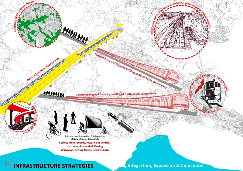
The base diagram reveals the project's fundamental spatial logic. Yellow and red highlighted routes trace elevated and subterranean transport corridors across Mumbai's topography, strengthening the critical north-south spine while stitching in new east-west links that the city has historically lacked. These corridors aren't highways. They accommodate cycling, walking, hoverboards, and plug-in electric vehicles, giving precedence to eco-friendly modes over private cars. The topographic base map is a deliberate choice: it reminds us that Mumbai is not a flat grid but a constrained coastal territory where every meter of right-of-way must serve multiple purposes.
The 5-Kilometer Module: Policy Embedded in Spatial Design
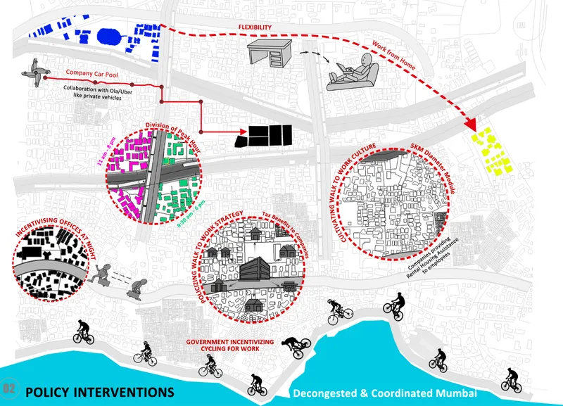
One of the sharpest ideas in the proposal is the 5-kilometer diameter module, a circular organizing unit that keeps workplaces within walking or cycling distance of residences. The plan drawing shows these modules as circular detail callouts, zooming into waterfront zones where cyclists populate reclaimed public space. Policy sits at the center of this strategy: walk-to-work culture, flexible working hours, company-led carpool programs with platforms like Ola and Uber, and government tax incentives for cycling commuters. The architects understand that infrastructure alone changes nothing if behavior doesn't follow.
What makes this compelling is the refusal to treat policy and architecture as separate disciplines. The 5-kilometer module is simultaneously a zoning tool, a mobility strategy, and a social contract. By embedding behavioral incentives into the spatial framework, the team sidesteps the usual trap of designing beautiful transit systems that nobody uses because the surrounding land use doesn't support them.
Vertical Space Optimization: Bi-Level and Tri-Level Road Systems
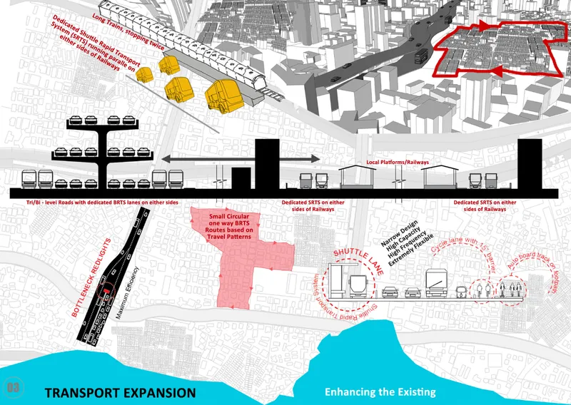
The axonometric drawing of the transport expansion proposals makes the vertical ambition clear. Elevated rail sections sit above shuttle routes, which in turn bridge surface streets to local train lines. The concept of "Vertical Space Optimization" introduces bi-level and tri-level road systems that redefine urban layering as an architectural opportunity rather than an engineering burden. Shuttle Rapid Transport Systems (SRTS) run along existing rail corridors, minimizing new land acquisition while increasing capacity. Small circular one-way routes are optimized for Bus Rapid Transit Systems (BRTS), reducing congestion at critical intersections.
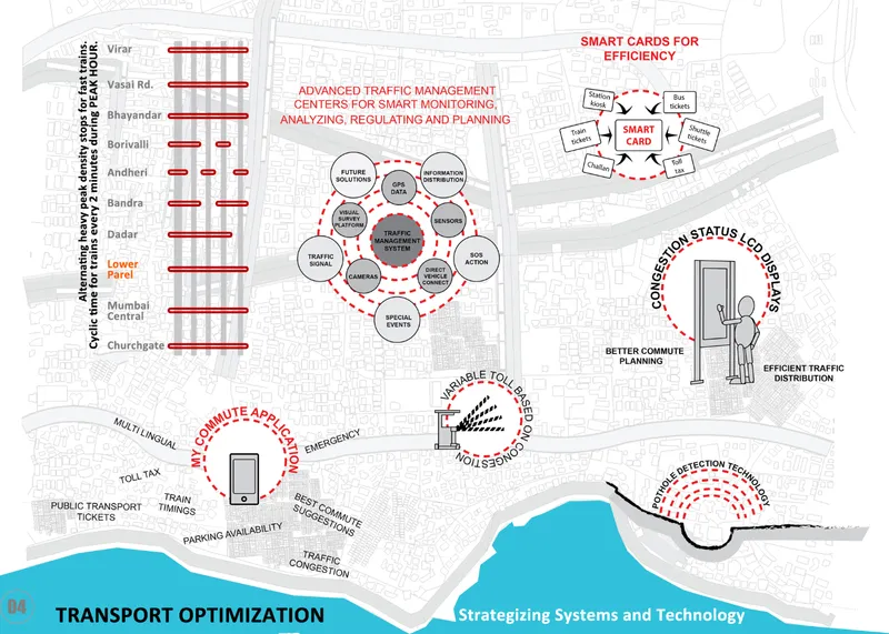
The companion diagram showing traffic management centers and smart card technology reveals the operational intelligence behind the physical infrastructure. Each layer of transit works in sync through centralized coordination, reflecting an ecosystemic approach where local trains, metros, buses, and shuttles share data, passengers, and purpose. Dense neighborhoods like Lower Parel could incorporate suspended walkways and dedicated cycle tracks without demolishing existing fabric. The architecture is modular and adaptable, designed to absorb future technologies without requiring wholesale replacement.
From Shuttles to Metro Tubes: Vehicle Design Meets Infrastructure
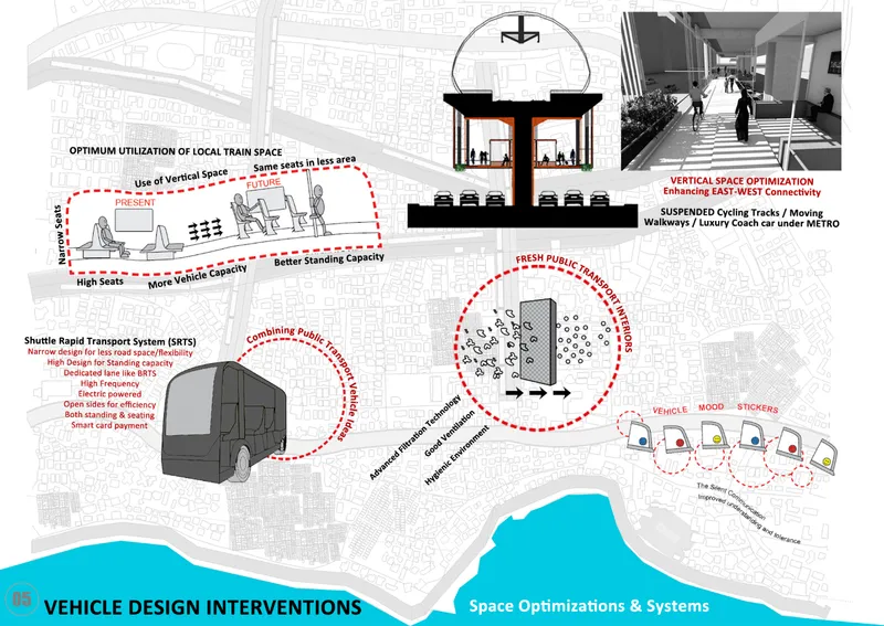
The section drawing of vehicle design interventions is where the proposal gets most inventive. Suspended cycling infrastructure hangs alongside shuttle systems in a cross-section that treats the street corridor as a multi-story building turned on its side. The design doesn't just move people; it turns commuting into an experience of interaction rather than isolation, transforming infrastructure into social space. Green mobility lanes and moving walkways occupy the lower levels while dedicated shuttle corridors operate above, each calibrated to a different speed and demographic.
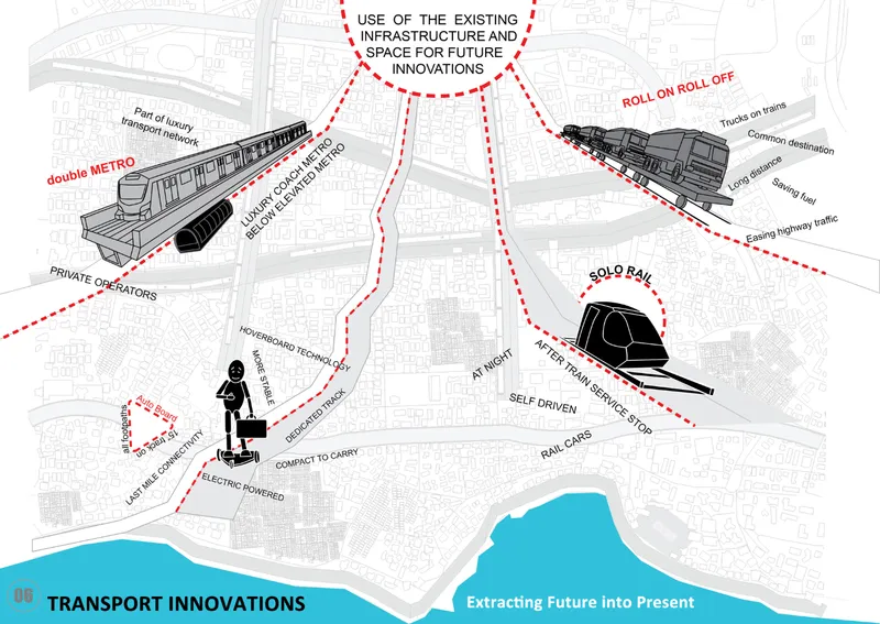
The innovation diagram radiating from a central node pushes further into speculative territory: metro tubes, autonomous vehicles, and freight systems branch outward as future extensions of the network. These aren't fantasies bolted onto the proposal as an afterthought. They emerge logically from the modular, layered framework established in the earlier strategies. If the base infrastructure is genuinely adaptable, then absorbing autonomous freight or vacuum-tube transit becomes an upgrade path rather than a revolution.
Why This Project Matters
The HyperLO(KAL) Mumbai matters because it treats urban transport as a design problem with spatial, social, and policy dimensions, not just an engineering challenge requiring more concrete. The 5-kilometer module, the vertical layering strategy, and the emphasis on cycling and pedestrian priority over private vehicles represent a coherent vision for a city that has long suffered from fragmented, siloed planning. Makhija, Bisht, and Borpujari demonstrate that young designers can think systemically, moving fluidly between the scale of a shuttle vehicle and the scale of a metropolitan network.
The proposal is ambitious, perhaps overly so in places. But ambition is precisely what Mumbai's mobility conversation needs. Too many transport plans for the city begin and end with a new rail line or a wider highway. This project insists that architecture has a role to play in coordinating those interventions into something greater than the sum of their parts. It turns infrastructure into habitat, corridors into communities, and policy into space. That synthetic thinking is what makes the Honorable Mention well deserved.
View the Full Project
About the Designers
Designers: Kirti Makhija, Ajay Bisht, Nihit Borpujari
Enter a Design Competition on uni.xyz
uni.xyz runs architecture and design competitions year-round that reward proposals with spatial conviction and real site intelligence.
Project credits: The HyperLO(KAL) Mumbai by Kirti Makhija, Ajay Bisht, Nihit Borpujari Hyperlocal (uni.xyz).


Popular Articles
Popular articles from the community

Opera by the Sea Estonia: Three Shells Dissolving Architecture into Tallinn's Coastline
A winning opera house proposal replaces monumental form with interconnected shells that blur the boundary between building, park and Baltic Sea.
Faces of the Soviet Avant-Garde: Turning Moscow's Street Names into an Open-Air Museum
A network of sculptural installations across a Moscow residential district transforms forgotten architect names into spatial encounters with cultural memor
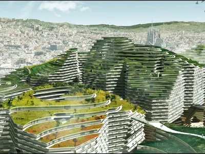
Manzana Morphosis: Stretching Barcelona's Grid into a Living Landscape for 2050
A radical reworking of the Eixample manzana turns density into a tool for generous public space, vertical ecology, and environmental performance.
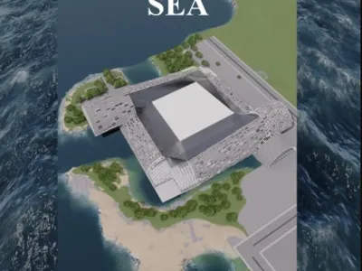
Opera on the Sea: Driftwood Logic Shapes a Timber Opera House on Estonia's Coast
Trevor Orgill's opera house translates the entangled drift of floating timber into a civic building where wood, water, and music converge.

Similar Reads
You might also enjoy these articles
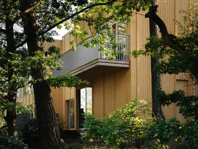
Sustainable Architecture Design: Embracing Nature and Modernity at Villa Solsidan
The article explores Villa Solsidan by AndrénFogelström, showcasing its sustainable architecture design and integration with the natural surroundings in Saltsjöbaden, Sweden.
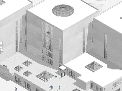
Scientific and Educational Monitoring Center of the Yenisei, Krasnoyarsk
Architecture as an instrument for ecological research, education, and environmental awareness along Russia’s largest river.
Development of Andretta Artist’s Village, Palampur, Himachal Pradesh, India
Reimagining Andretta as a living cultural landscape where art, architecture, and community converge to shape a global creative village.
Street Children Rehabilitation Center: A Model of Social Architecture for Community Rehabilitation
An inclusive social architecture project that transforms streets into nurturing environments, restoring dignity, identity, and opportunity for vulnerable children.

Comments (0)
Please login or sign up to add comments
No comments yet. Be the first to comment!