


Urban Morphology
Study of how cities form, evolve, and reorganize through design, infrastructure, and natural systems.
Urban morphology is the study of the physical form of cities: the pattern of streets, plots, blocks and buildings, and the processes that create and change that pattern over time. It treats the city as something that can be read, measured and compared, so that new design can work with the logic of an existing place instead of against it.
What is urban morphology?
The word morphology means the study of form, a term with deep roots in biology. Instead of looking at single buildings, urban morphologists look at the tissue those buildings make together. According to the Wikipedia overview of urban morphology, the discipline is not generally object-centred: it stresses the relationships between components of the city, and it tends to study ordinary, non-monumental areas as closely as famous ones.
Three ideas separate it from neighbouring fields. First, it works across scales, from the single plot to the region. Second, it is historical: a street pattern is understood as the result of many decisions made over centuries, each conditioned by what was already there. Third, it is analytical before it is propositional. Urban design proposes new form; urban morphology explains existing form, and good urban design usually starts with it.
The field is also interdisciplinary. The International Seminar on Urban Form (ISUF) began in 1994 when some 20 architects, geographers, planners and historians from four language areas came together, and it now publishes the peer-reviewed journal Urban Morphology. Related topics on uni.xyz include urban fabric and figure-ground drawing, one of the field's basic tools.
A short history of urban morphology
The field has several roots, usually grouped into an Italian, a British and a French school.
The Italian school grew from the work of the architect Saverio Muratori, which dates from the 1940s. Muratori tried to develop an "operational history" of the cities he studied, especially Venice and Rome, so that new buildings could be fitted into the syntax of the existing urban tissue. His assistant Gianfranco Caniggia developed this into a theory of building types that change through a continuous process, an approach now often called typomorphology.

The British school centres on the geographer M. R. G. Conzen. Born in Berlin in 1907, he moved to the UK in 1933, and his most influential work is a detailed study of the English market town of Alnwick, published in 1960. Conzen's "town-plan analysis" reads a town through three layers: the town plan, the pattern of building forms and the pattern of land use. The plan itself breaks down into streets, plots and the block-plans of buildings. His work is especially known for its close study of how individual plots evolve.

The French school, based mainly at the Versailles School of Architecture, focused on how built space sustains social practices. Among architects, a widely read book on the city is Aldo Rossi's The Architecture of the City (1966), which the Pritzker Prize announcement called a text of significance in the study of urban design and thinking when Rossi became the 1990 laureate.
"Out of this theoretical base came designs that seem always to be a part of the city fabric, rather than an intrusion."
A further strand, space syntax, was developed by Bill Hillier, Julienne Hanson and colleagues at The Bartlett, University College London, in the late 1970s and early 1980s, and gave the field a quantitative way to analyse street networks.
Key principles of urban morphology
Whatever school they come from, morphologists rely on a shared set of ideas about how cities are put together.
Form is read in layers: streets, plots, buildings
Conzen's three plan elements remain the basic vocabulary. In most towns, streets tend to be the most durable layer and can outlast every building along them. Plots, the parcels of land owned and built on, usually change more slowly than buildings but faster than streets. Buildings tend to be the most changeable. Reading these layers separately explains why an old street line can survive while its frontage has been rebuilt several times.
The block is the unit between street and building
Blocks set the grain of a city: their size and shape decide how many streets there are, how plots can be cut and how much ground stays open inside. Ildefons Cerdà's 1859 plan for Barcelona's Eixample is the textbook case, a regular grid of near-identical blocks laid out beside the dense old city, as the plan below shows.

Solid and void are read together
A figure-ground plan shows buildings as solid black and open space as white. The Wikipedia overview describes figure-ground theory as the study of building coverage as solid mass against open voids, and the aim of manipulating that pattern is to clarify a hierarchy of enclosed spaces. Giambattista Nolli's 1748 map of Rome is the classic precedent; see the figure-ground topic for a full account.
Type and tissue change together
In the Italian tradition, building types (the courtyard house, the row house, the apartment block) and the urban tissue they form are inseparable. A type adapts to its plot, and repeated types produce the character of a district. Typomorphology studies both at once, which is why it is so useful for designing infill that fits.
Configuration shapes movement
Space syntax breaks a street network into components, such as axial lines (straight sight-lines that are also possible paths), and analyses them as a network of choices. Its two best known measures, as described in the Wikipedia entry on space syntax, are integration (how many street-to-street transitions it takes to reach every other street) and choice, which the entry explains by imagining water poured into each street and divided at every junction. Some of these measures have been found to correlate with how people actually move.
Form follows ground, water and time
Topography and water structure many cities more than any plan. The thesis covered in the journal Structuring the Urban Form with Natural Systems, by Rohit Raj, maps catchments, slopes and runoff near Shimla and places urban functions according to their water demand, so supply can move by gravity rather than by pump.

Even planned cities drift away from their plans. The sociologist Robert E. Park made the point a century ago.
"The actual plan of a city is never a mere artifact, it is always quite as much a product of nature as of design."
Robert E. Park, "Community Organization and the Romantic Temper", in The City (1925)
Urban morphology on uni.xyz
Member work in this topic ranges from analytical theses to speculative city models. What links them is an interest in how form is generated: by water, by climate, by repetition, or by rules that let a city grow without a final masterplan.
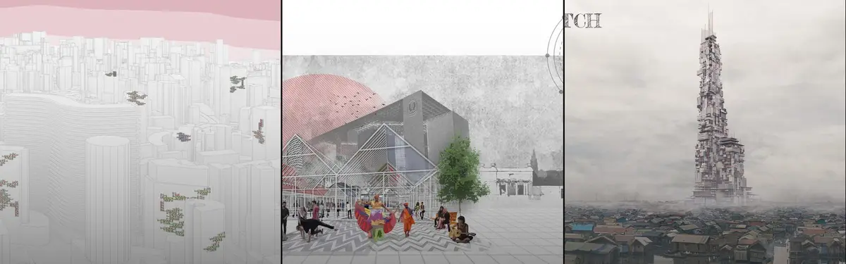
MIGHT[Y] SPACES, the most liked project in this topic, proposes a multi-scalar adaptive design method for Rio's uneven growth. Rather than a finished masterplan, it offers a density-organising strategy that runs from architectural to city scale.
Barcelona's grid recurs in this topic. The journal on Manzana Morphosis covers Ruben Andersen's proposal, an Editor's Choice entry in the Hyperblock competition, which takes Cerdà's Eixample blocks and subjects them to vertical stretching, deep carving and topographical transformation. Courtyards climb upwards, roofs become landscapes and density is used to produce more nature, not less.
"What happens when you take one of the most celebrated urban grids in history and refuse to treat it as finished?"
UNI Editorial, Manzana Morphosis: Stretching Barcelona's Grid into a Living Landscape for 2050

In the same competition, Customized Instant City Module Operating System by Wanzhu Jiang and jiaqi wang received an Organizer's Choice Award for an urban renewal plan for the Eixample based on post-metabolism, phased from 2020 to 2050. Incremental City by Yiwei Qian, AUSTIN NG and YULU WANG, an Editor's Choice entry in the Ignite competition, imagines a self-growing super block built by incremental construction, with vertical gardens and public space.
Several projects let climate generate the plan. Hexagon City by Piet Scholten, a People's Choice Award winner in the EHC - Sahara competition, makes optimal use of land with materials found on site and low-tech solutions for energy, water, shade and cooling. Weaving Water by Shuchuan Yang, Jiani Li and Jiayan Shao, the winning entry in the same competition, designs prototype cities that act as giant water intakes and catchments, linked by resource-sharing pipelines.

Other members work on the voids. Le MONSTRE de Clignancourt by Johan Steenberg, an Honorable Mention in the Salut Paris competition, argues that as Paris builds upwards it loses touch with its soils, and uses light and shelter to reveal the urban voids and the creatures living in them.

Challenges and future directions
Urban morphology faces three practical problems. The first is data. Historical maps, plot records and building surveys are uneven between countries, and in fast-growing cities much of the form is informal and unmapped. The second is translation: analyses that explain a city beautifully do not automatically produce design rules, and the gap between the geographer's description and the architect's proposal is still wide. The third is change in use. A form can stay intact while its life drains away, a problem Tasneem Vali examines in the journal From Vibrancy to Vacancy, which looks at the gradual underuse of buildings in cities such as Mumbai, where land is scarce.

Digital tools are reshaping the field. Space syntax already runs on computer models, and parametric methods let designers test how a rule for plots or heights plays out across a whole district. The risk is that fast computation replaces slow reading. The strongest work still begins with walking a place and drawing it by hand.
Urban morphology for students and designers
A morphological analysis is one of the most common studio and thesis exercises. A workable sequence looks like this:
- Define the study area and scale. Choose a district small enough to survey but large enough to show more than one pattern, and decide which scales you will compare (region, district, block, plot).
- Collect maps from several dates. Old survey maps, cadastral plans and current base maps let you see what has persisted and what has changed.
- Draw a figure-ground. Fill buildings black and leave open space white, then invert it to study the shape of the open space.
- Map the street network and blocks. Record street widths, block sizes and how many routes lead into each block.
- Map plots and building types. Note plot widths and depths along a street, and classify buildings by type and age.
- Divide the area into zones of similar form. Group areas with the same street, plot and building pattern, and date them.
- Turn findings into rules. State what any new building should respect, such as plot width, building line, height or courtyard depth, before you design.
For thesis angles, look at fringe areas where the urban pattern changes abruptly, infrastructure leftovers such as the former viaduct land used in the journal on M.A.U Museum of Urban Art in Rome, or the block design of a planned grid under new pressures. Browse open architecture competitions for briefs that ask you to rework an existing city fabric.
Frequently asked questions
What is urban morphology in simple terms?
It is the study of the shape of cities: how streets, plots, blocks and buildings fit together and how that pattern has changed over time.
What are the main elements of urban morphology?
Following Conzen, the town plan is made of streets, plots and buildings, read alongside the pattern of building forms and the pattern of land use. Many analyses also add blocks, open spaces and natural features such as rivers and slopes.
What is the difference between urban morphology and urban design?
Urban morphology analyses and explains existing urban form. Urban design proposes new form. In practice, a morphological study is often the first stage of an urban design project.
What is typomorphology?
Typomorphology is an approach rooted in the Italian school of Muratori and Caniggia that studies building types and urban form together, on the basis that types shape the city and the city shapes types.
What is space syntax used for?
Space syntax analyses the configuration of streets and spaces as a network. Designers and planners use it to estimate how well connected a street is and how a new layout might change patterns of movement.
References and further reading
- Urban morphology, Wikipedia
- M. R. G. Conzen, Wikipedia
- Space syntax, Wikipedia
- About ISUF, International Seminar on Urban Form
- Aldo Rossi, 1990 Laureate, The Pritzker Architecture Prize
- The City, by Robert E. Park, Ernest W. Burgess and Roderick D. McKenzie (1925), Project Gutenberg


Popular projects
View all 57 projects


Latest journals
View all 49 journals
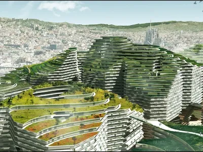
Manzana Morphosis: Stretching Barcelona's Grid into a Living Landscape for 2050
A radical reworking of the Eixample manzana turns density into a tool for generous public space, vertical ecology, and environmental performance.

Terrain Anamorphosis: Erosion as a Design Tool for Regenerating Athens' Kifisos River
A proposal for Athens' Kifisos River that lets controlled water carve terraces, basins and fragments into the ground around an abandoned power station.
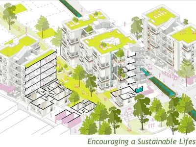
Productive Organism: A Mumbai Thesis That Treats Peripheral Housing as a Tool for Ecological Repair
Amod Nargund's thesis for Marve, Malvani layers mangrove ecology, adaptive housing and water cycles into a habitat that works like a living organism.
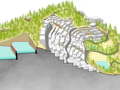
Structuring the Urban Form with Natural Systems: Letting Water Plan Shimla's Next Growth
Rohit Raj's thesis maps catchments, slopes and runoff near Shimla, then places urban functions by water demand so gravity does the work of pumps.


