
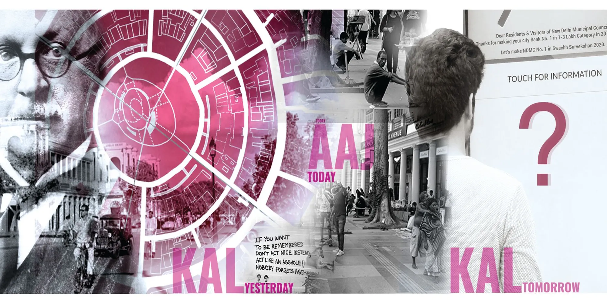
Neo-Delhi: Reimagining Connaught Place as a Multi-Tiered City of 2112
A shortlisted competition entry layers hyperloop transit, floating terraces, and heritage voids over Delhi's colonial core.


What happens when you stack a century of urban ambition on top of a colonial-era roundabout? Umar Sameer answers that question by treating Connaught Place not as a monument to preserve under glass but as a living foundation for an entirely new vertical city. The proposal, titled Kal | Aaj | Kal (Yesterday | Today | Tomorrow), reads Delhi's most iconic commercial district through six critical lenses: social, political, cultural, economic, ecological, and accessibility. It then projects those readings forward to 2112, proposing a multi-tiered urban structure that literally rises from the existing fabric, complete with a levitating skywalk, vertical farming systems, and hyperloop transit corridors.
Shortlisted in the Neo-Delhi competition on uni.xyz, the project positions Connaught Place's circular geometry as the DNA for a future city model. Edwin Lutyens designed the original plan in 1912 as a hub for Delhi's colonial elite. Over the past century, it has become radically democratic: hawkers, cobblers, street artists, office workers, tourists, and senior citizens all share the same concentric rings of space. Sameer's proposal takes that organic inclusivity and codifies it into a spatial framework where public, commercial, and ecological programs coexist across stacked platforms, bridged islands, and breathable voids mapped to Delhi's seven historic cities.
Cantilevered Floors Around a Central Green Lung
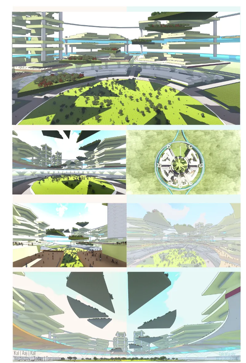
The axonometric composite drawing reveals the project's core architectural move: stacked cantilevered floors that radiate outward from a preserved central green park. Each tier hosts a different programmatic zone, from hybrid office-market spaces at lower levels to elevated ecological terraces higher up. The geometry remains faithful to Connaught Place's circular plan, but the vertical extrusion transforms a two-dimensional colonial layout into a three-dimensional urban ecosystem. The central void is not leftover space; it is the project's primary public asset, a ground-level park that anchors the entire structure and provides daylight, ventilation, and visual relief to the dense tiers above.
Mapping Human Stories onto the Circular Grid
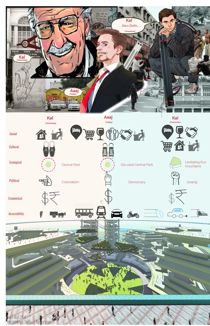
One of the project's most distinctive contributions is its insistence on stakeholder-level granularity. The presentation board pairs illustrated portraits of C.P.'s actual users with iconographic diagrams that categorize activities by age, gender, and time of day. Hawkers occupying peripheral arcs in the morning, office workers flooding the inner ring at midday, families reclaiming the outer circle in the evening: these patterns become the generative data for spatial allocation in the 2112 scheme. The aerial rendering of the circular masterplan, shown alongside these portraits, makes it clear that the future geometry grows directly from present-day behavior rather than from abstract planning ideals.
This human-centric mapping approach also addresses observed failures in the current site. Fragmented public space, traffic congestion choking the inner circle, and underused green zones are identified as challenges. The proposal responds with pedestrian-first planning, green roofs integrated into every cantilevered tier, and sustainable transport connections that decouple vehicular movement from the public realm entirely.
Six Circular Platforms Bridged Over Water
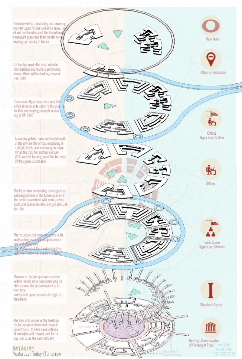
The vertical sequence of plan drawings introduces an unexpected element: water. Six circular island platforms sit at different elevations, connected by bridges that span reflective pools or channels below. The arrangement references Delhi's historic relationship with the Yamuna floodplain while creating a new ecological infrastructure within the city center. Each island functions as a semi-autonomous neighborhood with its own mix of residences, markets, and public amenities, connected to the larger network through the Halo Walk, a levitating skywalk designed for public introspection and community engagement. The floating ecological terraces that surround this skywalk serve double duty as vertical farming zones and stormwater management surfaces.
Nine Analytical Lenses on a Single Circle
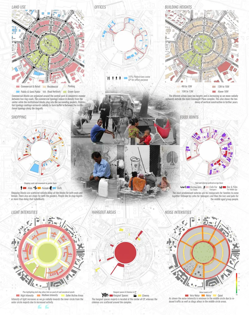
The analysis board presents nine circular diagrams, each mapping a different parameter onto Connaught Place's footprint: land use, building heights, light intensity, noise levels, gender-based occupancy, transport connectivity, and environmental data. Read together, they form a comprehensive diagnostic portrait of a site under stress. Light and noise intensity maps reveal zones of sensory overload that correlate with traffic congestion points. Gender-based occupancy data exposes time-of-day disparities in who feels safe enough to use certain parts of the circle. These aren't decorative infographics; they are the evidence base for every design decision in the 2112 proposal, from where green roofs are placed to how hyperloop stations are positioned relative to pedestrian desire lines.
Heritage Continuity Through Vertical Growth
Perhaps the most provocative idea in the project is the refusal to choose between conservation and reinvention. The new structure literally rises from the existing one, treating Lutyens' colonnaded arcades as a plinth rather than a relic. Void zones are mapped to correspond with Delhi's seven historic cities, creating deliberate pauses in density. These voids allow for green growth, natural ventilation, and moments of spatial reflection that counterbalance the intensity of the stacked program above. The result is a palimpsest: every layer of the new city acknowledges the one beneath it, from 1912 to 2112.
Why This Project Matters
Speculative urban visions for the year 2112 risk drifting into pure science fiction, untethered from the messy realities of existing cities. What grounds Sameer's proposal is its rigorous attention to the present: the activity maps, the stakeholder portraits, the nine-layer site analysis. The future city is not a blank-slate fantasy but a direct spatial response to data collected from today's Connaught Place. That methodology, projecting forward from granular observation rather than backward from a utopian endpoint, gives the scheme a credibility that many competition entries at this scale lack.
The project also raises a question worth sitting with: can a central business district designed by a colonial power become a genuine instrument of Swaraj, of collective self-rule? Sameer's answer is architectural. By distributing program vertically, bridging isolated zones, preserving heritage as foundation rather than artifact, and designing void spaces that invite pause, the proposal sketches a Connaught Place that belongs to everyone who already uses it. Whether or not floating terraces and hyperloop tunnels arrive by 2112, the underlying argument for inclusive, data-driven, heritage-conscious urban design is one that Delhi needs right now.
View the Full Project
About the Designers
Designer: Umar Sameer
Enter a Design Competition on uni.xyz
uni.xyz runs architecture and design competitions year-round that reward proposals with spatial conviction and real site intelligence.
Project credits: Kal | Aaj | Kal" (Yesterday | Today | Tomorrow) by Umar Sameer Neo-Delhi (uni.xyz).



Popular Articles
Popular articles from the community


Co-life: Sustainable Architecture for Age-Friendly Community Living
Co-life reimagines sustainable architecture for seniors through courtyards, rammed earth, shared gardens, and spaces designed for belonging.
The Earth Pod: 3D Printed Homes for Resilient Refugee Communities
The Earth Pod reimagines refugee housing through 3D printed homes made from clay, combining resilience, self-sufficiency, and rapid shelter.
Riyadh For All: Intergenerational Urban Design for Active Aging in Rabat
Riyadh For All reimagines urban design in Rabat with intergenerational co-living, adaptive courtyards, and Moroccan cultural exchange today.

Play: Fragments of Their World
Familiar architecture becomes modular playground design, creating safe spaces where displaced children can learn, connect, imagine and play.


Similar Reads
You might also enjoy these articles
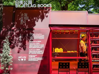
Day and Night Park: A Time-Based Urban Newsstand in Beijing
A temporary urban newsstand in Beijing blending travel, light, and reading through poetic colors, compact form, and community-focused design.

Modernist Patio Renovation in El Masnou, Barcelona by Oliver Segura Arquitectura + Cebrià Arquitectura
Modernist patio renovation blending tradition and innovation with a movable pool, leveled floors, and Catalan materials in El Masnou.
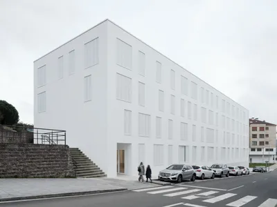
Alto Residencial Coop: Cooperative Housing Development in Santiago de Compostela by Carbajo Barrios Arquitectos
A linear cooperative housing complex blending white volumes and perforated metal façades, enhancing community living, natural light, privacy, and urban integration.
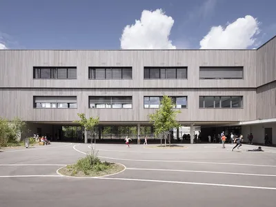
Vil Genis School by BPA ARCHITECTURE – Massy, France
Vil Genis School in Massy, France, features sustainable design, south-facing classrooms, community integration, accessible spaces, and modern educational architecture.

Comments (0)
Please login or sign up to add comments
No comments yet. Be the first to comment!