
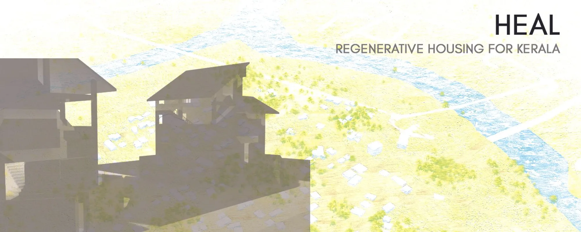
NavJeevan: Regenerative Housing That Treats Floods as Ecology, Not Emergency
A shortlisted HEAL+ entry proposes flood-resilient vernacular housing in Kerala's Uliyannoor, weaving wetlands, raised plinths, and community spaces into o


When Kerala's worst floods in a century killed 483 people and displaced millions in August 2018, the typical rebuilding response was to reconstruct what had been lost. NavJeevan asks a sharper question: what if the architecture itself could absorb, redirect, and coexist with floodwater rather than simply resist it? Sited in Uliyannoor, Aluva, a settlement in Ernakulam district pinched between the Periyar River and chronic waterlogging, the project treats the flood not as an anomaly to be engineered away but as a seasonal reality that architecture must metabolize.
Designed by Linda Elsa Baby, Manali Jamgaonkar, and Sanskriti Jindal, NavJeevan was shortlisted in the HEAL+ competition. The entry layers hydrological analysis, vernacular material intelligence, and community programming into a single regenerative masterplan, proposing a replicable model for flood-prone regions far beyond Kerala.
Reading the Territory Before Drawing on It
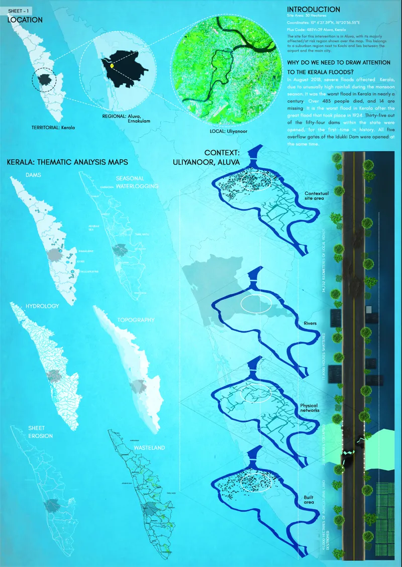
The project opens with a rigorous suite of thematic analysis maps that chart Kerala's hydrology, topography, sheet erosion patterns, wastelands, and flood-prone zones at the regional scale. These are not decorative diagrams. They establish a direct causal chain: the Periyar River's behavior, the district's low-lying terrain, and the erosion profiles that make Uliyannoor one of the most vulnerable pockets in Ernakulam. By foregrounding this evidence, the designers make a clear case that any architectural intervention here is meaningless without first understanding the water.
Wetlands as Infrastructure, Canals as Architecture
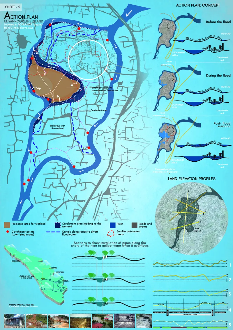
The action plan translates that analysis into spatial strategy. Proposed wetland expansions function as natural flood buffers, absorbing peak water loads before they reach inhabited zones. Strategic catchment points and redirected canals manage excess runoff along the river corridor, while elevated pathways maintain pedestrian connectivity even when the ground plane is submerged. The land elevation profiles drawn alongside the plan make the logic legible: every meter of grade change is accounted for.
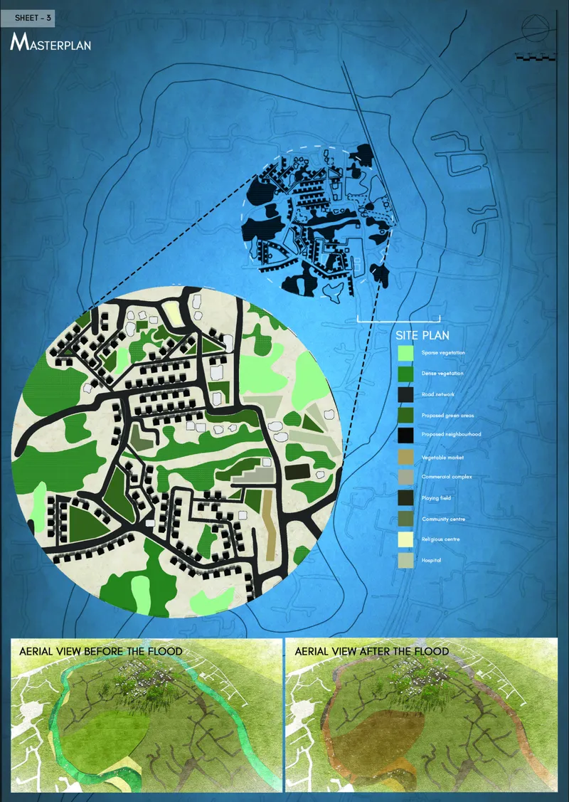
The masterplan extends this logic into a full neighborhood. Dense and sparse vegetation zones, green belts, playing fields, vegetable markets, a commercial complex, community centers, healthcare facilities, and religious institutions are distributed across the site. Aerial comparisons of conditions before and after flooding show how the proposed layout performs under stress. The settlement is not designed for fair weather alone; it is designed to remain functional, connected, and safe when the Periyar rises.
A Housing Unit Built for Three Scenarios
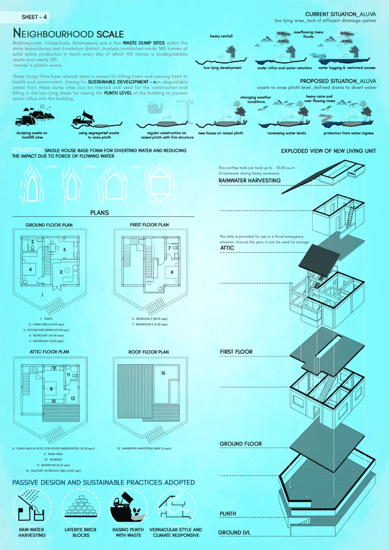
At the scale of the individual dwelling, the designers pack a remarkable density of flood-responsive features into a compact unit. Raised plinths lift living spaces above predicted water levels. Rainwater harvesting tanks ensure water security during dry spells. Clay tile roofs, a staple of Kerala's vernacular tradition, prevent monsoon leakage while keeping the carbon footprint low. The most striking detail is the emergency attic space: a safe zone accessible via external staircases that doubles as an evacuation route during peak floods. The exploded axonometric drawing makes each of these systems visible, pulling apart the building to show how rainwater harvesting, waste management, and structural elevation work as an integrated kit.
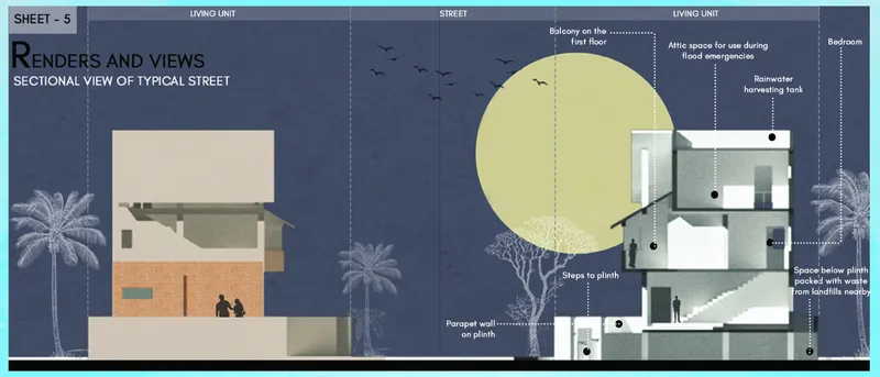
The section view places these units in their street context, flanked by palm trees and bathed in warm light. It is a deliberately atmospheric drawing, but it communicates something important: this is not emergency shelter. It is permanent housing that happens to be flood-proof. The external staircases, the covered balconies, the rhythm of clay tile rooflines all signal continuity with Kerala's residential culture rather than a break from it.
Terracotta Clusters and the Vernacular as Climate Strategy
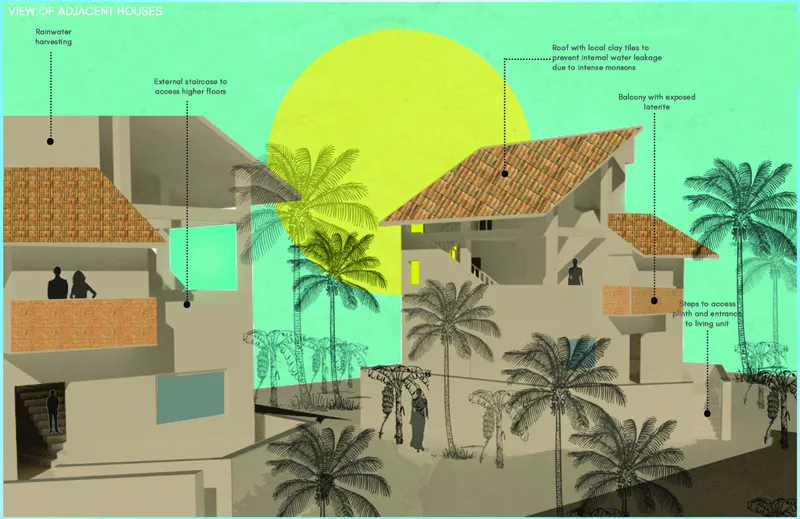
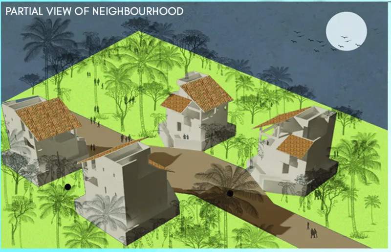
The perspective rendering and cluster axonometric reveal how individual units aggregate into a neighborhood with its own spatial character. Terracotta roofs cascade across the composition, punctuated by palm canopies and shared green spaces. Exposed laterite walls, clay tiles, and recycled waste materials are not aesthetic choices alone; they are thermal, structural, and ecological ones. Local sourcing reduces embodied energy. The material palette breathes in Kerala's humid climate. And the cultural familiarity of these surfaces builds social trust in a community already traumatized by disaster.
Shared courtyards and walkways thread between clusters, creating the kind of incidental social space that fosters collective resilience. These are not leftover gaps between buildings. They are the connective tissue of a community designed to support itself before, during, and after a flood, from daily vegetable markets to emergency evacuation routes.
Why This Project Matters
NavJeevan's strength is its refusal to separate disaster response from everyday architecture. Too many post-flood interventions treat resilience as an add-on: a higher plinth here, a water tank there, grafted onto housing typologies that were never designed for the context. This project starts from the water itself, maps its behavior at the regional and site scales, and then builds upward through wetland infrastructure, community programming, and vernacular material systems. The result is a housing model where flood resilience is not a feature but the organizing principle.
For a competition entry by three young designers, the ambition is notable. Linda Elsa Baby, Manali Jamgaonkar, and Sanskriti Jindal have produced a proposal that operates convincingly at three scales: the territory, the settlement, and the dwelling. If the 2018 Kerala floods taught anything, it is that reconstruction without rethinking is just waiting for the next disaster. NavJeevan offers the rethinking.
View the Full Project
About the Designers
Designers: Linda Elsa Baby, Manali Jamgaonkar, Sanskriti Jindal
Enter a Design Competition on uni.xyz
uni.xyz runs architecture and design competitions year-round that reward proposals with spatial conviction and real site intelligence.
Project credits: NavJeevan by Linda Elsa Baby, Manali Jamgaonkar, Sanskriti Jindal.




Popular Articles
Popular articles from the community

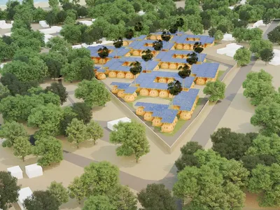
The Earth Pod: 3D Printed Homes for Resilient Refugee Communities
The Earth Pod reimagines refugee housing through 3D printed homes made from clay, combining resilience, self-sufficiency, and rapid shelter.

The Ocean Hive: Sustainable Architecture for a Self-Sufficient Civilization at Sea
The Ocean Hive imagines sustainable architecture at sea, where modular habitats, algae, wave power and ocean waste sustain a growing colony.

Co-Life: Senior Housing Design That Reconnects Older Adults With the City
Co-Life reimagines senior housing design through healing gardens, shared streets, workshops, and a sustainable community across generations.

Co-life: Sustainable Architecture for Age-Friendly Community Living
Co-life reimagines sustainable architecture for seniors through courtyards, rammed earth, shared gardens, and spaces designed for belonging.

Similar Reads
You might also enjoy these articles
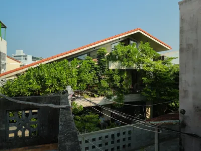
Bao Huynh Watercolor Atelier: A Serene Art Retreat in Hội An
Bao Huynh Watercolor Atelier in Hội An blends multifunctional art spaces, sustainable design, local materials, and family-friendly living in a serene environment.
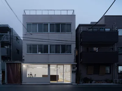
Atelier Macri Concept Store Interior Design by CASE-REAL
Atelier Macri store features a "ko" counter, walnut wood details, cork displays, blending retail, gallery, and seamless customer experiences.
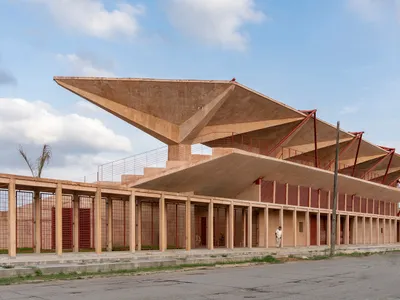
Manuel Vargas Izquierdo Stadium and High-Performance Sports Center: Architectural Excellence in Jalpa de Méndez
The Manuel Vargas Izquierdo Stadium blends sustainable design, inclusive sports facilities, and cultural-inspired architecture, revitalizing Jalpa de Méndez’s public spaces.
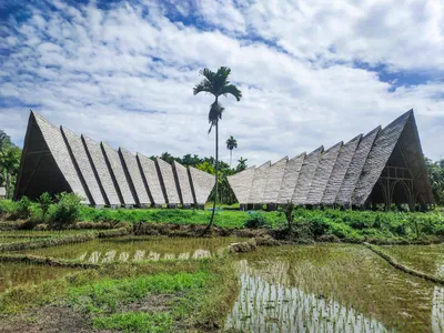
KAKR Buluh Awar Hall: Revitalizing Community and Ecology Through Bamboo Architecture
Community built bamboo hall revitalizes Buluh Awar village, empowering youth, restoring ecology, celebrating vernacular craftsmanship through sustainable architecture and culture.





Comments (0)
Please login or sign up to add comments
No comments yet. Be the first to comment!