
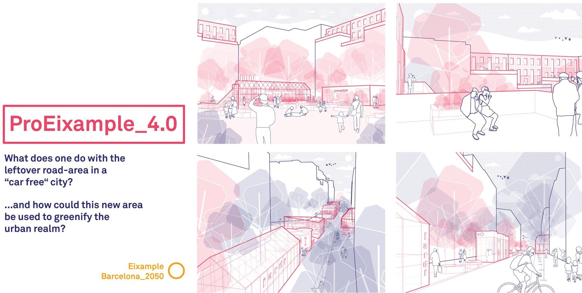
ProEixample 4.0: A Parametric Urban Design Strategy for Barcelona’s Car-Free Future
Parametric urban design reclaims Barcelona’s streets, transforming car-free space into green, adaptive public realms for future cities.
In the evolving discourse of contemporary architecture, parametric urban design has emerged as a critical methodology for addressing complex urban challenges. The project ProEixample_4.0, developed by Paul Strobel, Max Blake, and Jochen Schumacher, stands as a compelling exploration of how data-driven urbanism can reshape the future of Barcelona.
Recognized as the Winner entry of Hyperblock, the proposal investigates the transformation of Barcelona’s Eixample district through the lens of the Superblock model. It raises two fundamental questions: what happens to leftover road infrastructure in a car-free city, and how can this reclaimed space be reprogrammed to enhance urban ecology?
Historical and Urban Context: Mapping the DNA of Barcelona
The project begins with an extensive historical analysis of Barcelona, tracing eleven thematic layers from ancient myths to post-COVID urban realities. These themes include political conflict, infrastructure, migration, ecology, commerce, and cultural production.
Rather than treating the city as a static artifact, the authors interpret Barcelona as a dynamic system of urban manifestations, shaped by overlapping socio-political and environmental forces. This analytical framework reveals how infrastructural decisions, migration patterns, and economic shifts have continuously redefined spatial organization.
By translating these insights into visual timelines and data mappings, the project establishes a robust foundation for a responsive and adaptive urban design strategy.
City-Scale Analysis: Reading Urban Patterns Through Data
At the city scale, the proposal dissects Barcelona’s spatial behavior through layered mappings. These diagrams highlight how migration shapes density, how top-down planning strategies often fail over time, and how bottom-up interventions materialize in physical space.
The analysis identifies Barcelona as:
- A bounded city constrained by geography
- A dense hub of commerce and mobility
- A site of political discourse and cultural production
- A tourist-driven urban economy
This multi-scalar reading reinforces the need for a design approach that is not only spatially responsive but also socially and economically aware. The groundwork for a parametric urban design system is thus established, where multiple variables can inform future interventions.
Block-Level Intervention: The Eixample as a Testing Ground
The Eixample district becomes the primary site of experimentation. Through detailed block analysis, the project uncovers critical inefficiencies in land use, particularly the dominance of vehicular infrastructure over public space.
Key findings include:
- 97% of housing is privately owned
- A significant portion of public realm is allocated to cars
- Courtyards and rooftops remain underutilized
By quantifying these conditions, the project identifies latent spatial potential within existing urban fabric. The introduction of the Superblock concept reduces vehicular dominance and opens up new opportunities for redistribution of space.
Future Scenarios: Projecting Barcelona 2050
Using the futures wheel methodology, the proposal outlines six speculative trajectories including democracy 4.0, global migration patterns, green technologies, and post-COVID urban shifts.
These scenarios envision a city where:
- Digital platforms enable participatory governance
- Climate-responsive infrastructure becomes essential
- Urban density is optimized rather than expanded
- Public space evolves as a hybrid of social, ecological, and economic functions
This forward-looking framework positions the project within a broader architectural discourse on resilience and adaptability.
The ProEixample 4.0 Strategy: A Parametric Urban Design Framework
At its core, ProEixample_4.0 proposes a system rather than a fixed design. It introduces a governance and spatial mechanism through a Community Land Trust (CLT), which acts as a mediator between public authorities, residents, and private stakeholders.
The strategy unfolds in four steps:
- Establishing a CLT to manage land collectively
- Transferring streets and rooftops into shared assets
- Providing incentives to unlock underutilized courtyards
- Enabling spatial trading between stakeholders
This approach allows for incremental transformation, aligning with principles of bottom-up urbanism while maintaining systemic coherence.
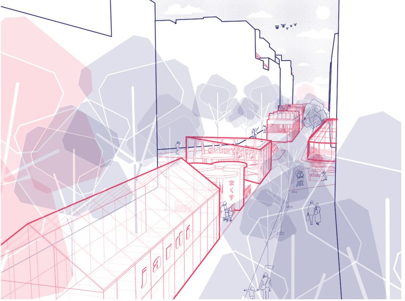
Spatial Transformation: From Streets to Public Realms
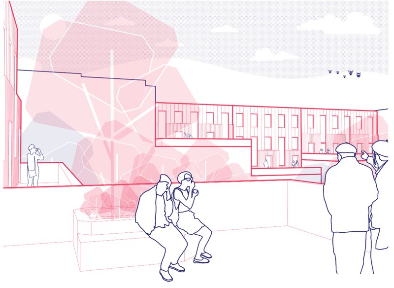
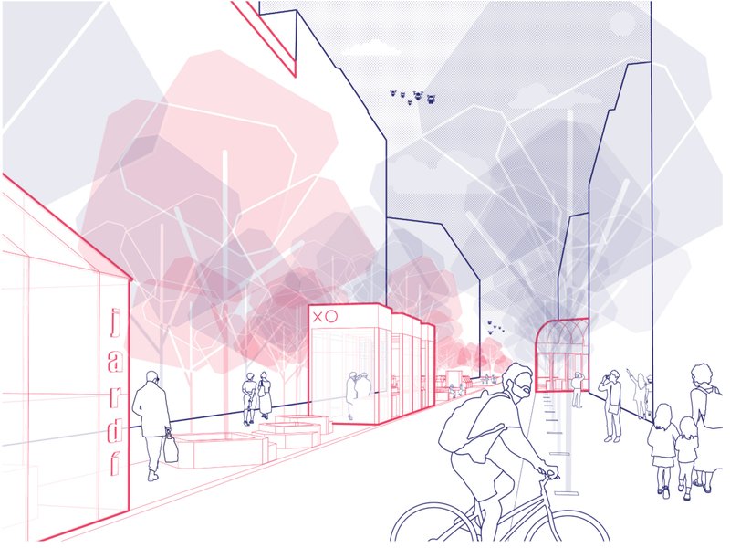
The proposal redefines the spatial hierarchy of the city by converting vehicular zones into pedestrian-oriented landscapes. Streets become social corridors, courtyards transform into green commons, and rooftops evolve into active public platforms.
Quantitatively, the intervention achieves:
- Significant increase in accessible green space per resident
- Reduction in car-dominated infrastructure
- Enhanced spatial connectivity across blocks
The integration of green typologies such as pocket parks, rooftop gardens, and courtyard ecosystems introduces ecological performance into the urban core.
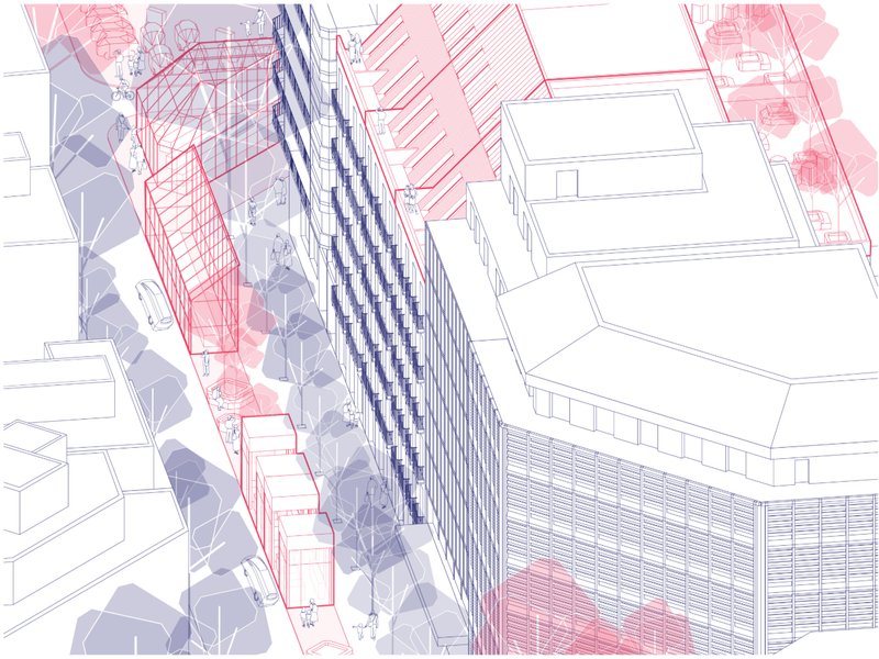
Architectural Expression: Axonometric and Sectional Clarity
The project is distinguished by its rigorous visual communication. Exploded axonometrics, sectional studies, and system diagrams articulate the transformation with precision.
These drawings do not merely illustrate form but convey process. They demonstrate how incremental interventions accumulate into a coherent urban system, reinforcing the logic of parametric urban design.
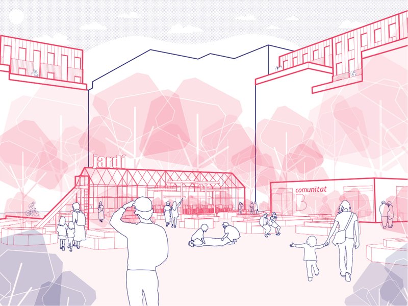
Public Space and Social Life: Reclaiming the Ground
At ground level, the proposal envisions a vibrant mix of cultural, economic, and recreational programs. Public squares emerge within former road networks, supporting community interaction and local economies.
Courtyards, once privatized and inaccessible, become shared spaces during the day while retaining flexibility for controlled use at night. This duality reflects a nuanced understanding of privacy and collective ownership.
Juror Insights: Critical Evaluation
The project received strong recognition for its analytical depth and clarity of vision.
Pere Buil (Juror) noted: The proposal achieves a balance between respect for the existing city and forward-thinking strategies. It presents a powerful analysis of the Eixample’s current metabolism while addressing density in a realistic and feasible manner. The clarity of drawings and axonometrics strengthens the narrative.
Joan Roig Duran (Juror) highlighted: The project demonstrates deep analysis and strong graphical communication. While the proposal is respectful and well-developed, a more concise synthesis could enhance clarity and accessibility of ideas.
These evaluations reinforce the project’s strength in combining rigorous research with speculative design thinking.
ProEixample_4.0 positions itself as more than a site-specific intervention. It proposes a scalable framework for rethinking urban infrastructure in the age of climate change and post-automobile cities.
By leveraging parametric urban design, the project transforms constraints into opportunities, enabling cities to adapt, evolve, and regenerate from within.
As urban environments worldwide grapple with similar challenges, this proposal offers a compelling blueprint for reclaiming space, redistributing resources, and redefining the relationship between architecture and the city.

Popular Articles
Popular articles from the community
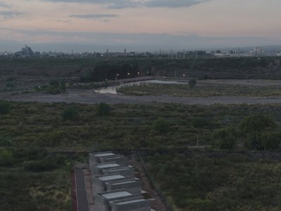
ONA Threads Four Board-Formed Concrete Cabins Along a 260-Meter-Deep Site in Mendoza
At the edge of Argentina's wine country, a set of curved concrete lodges negotiate a razor-thin parcel between city and mountain.
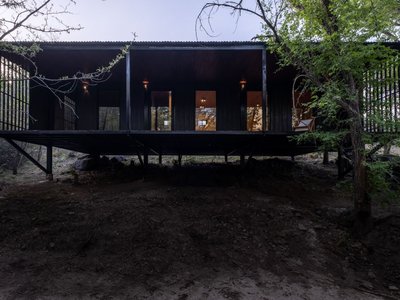
Pablo Senmartin Suspends a Steel-and-Timber Refuge Above a River Forest in Córdoba
An 80-square-meter dwelling on pilotis camouflages itself among the trees of Mayu Sumaj, designed to be dismantled without waste.
Non Architecture's Horrible Houses Competition Asks AI to Design the Ugliest Home Possible
A free global competition invited participants to use AI image generators to produce the most hideous house they could imagine.
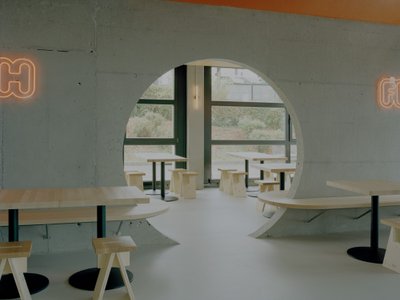
Noue Studio Organizes a Swiss Restaurant Around a Single Concrete Wall
In Granges-Paccot, Switzerland, a 216-square-meter renovation turns raw materials and a central spine into a legible dining experience.

Similar Reads
You might also enjoy these articles

Urban Forest: A Vertical Ecosystem for 5,000 Workers in Singapore's Changi Business Park
Radially stacked pods and layered green decks turn a 7-acre plot into 47 acres of ecological workspace projected for 2040.
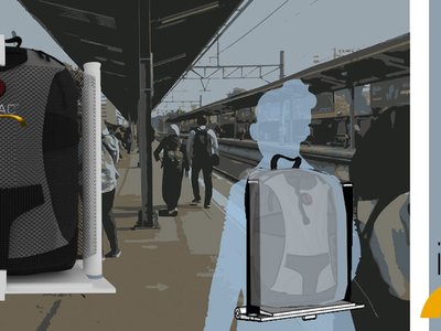
interACT: A Wearable Transit Object That Turns Commuting Into Social Infrastructure
A backpack-mounted foldable device transforms walking, waiting, and riding into moments of shared comfort across Jakarta's transit network.
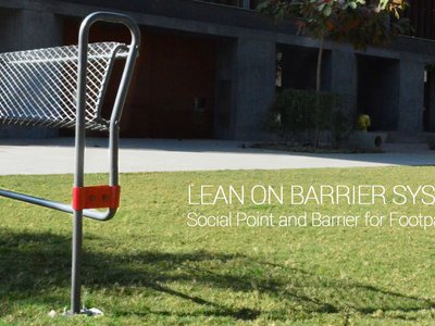
Lean On Barrier System: Where Traffic Safety Meets Chai Culture in Ahmedabad
A modular steel barrier doubles as informal seating and lean-on furniture at one of Ahmedabad's busiest intersections, keeping vendors in place.

The Black Bagh: A Living Monument Built from Water, Light, and Memory
On the banks of the Yamuna, two designers replace the myth of a marble mausoleum with a regenerative landscape of reflection and ritual.


Comments (0)
Please login or sign up to add comments
No comments yet. Be the first to comment!