

Meet-in-the-Middle: A Pedestrian-First Mobility Network for Mumbai
Three interlocking systems of cable cars, elevated parks, and a central hub reimagine last-mile connectivity across one of the world's densest cities.


Fifteen million walking trips happen in Mumbai every single day, yet the city's transit infrastructure barely acknowledges the pedestrian. Rail corridors slice through neighborhoods without connecting them at street level. Highways carry traffic over communities that remain spatially and socially disconnected from one another. Meet-in-the-Middle confronts this paradox head on, proposing a layered urban mobility system that treats walking, cycling, and cable car transit as serious infrastructure rather than afterthoughts.
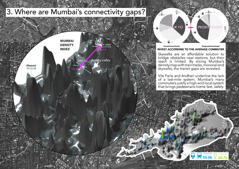
Designed by B.N.P MARS and Duval Annabelle, the project identifies three interconnected urban failures in Mumbai: connectivity gaps between transit lines and the neighborhoods they serve, streets saturated beyond their capacity, and a fragmented city fabric where suburban sprawl has severed the relationship between periphery and core. The response is a scalable, three-part strategy that layers aerial connectors, green elevated corridors, and a metropolitan hub into Mumbai's existing infrastructure, targeting high-density zones like Dharavi, Andheri, and Vile Parle first.
Mapping the Disconnect: Density, Transit, and the Spaces Between


The analytical groundwork here is rigorous. Transit infrastructure is overlaid with colored density zones and connectivity ratios, revealing where Mumbai's rail and highway networks fail to integrate with the communities they physically pass through. Exhibition boards mounted on scaffolding under an exposed timber roof present the research as a spatial argument: density is not the problem. The problem is that density goes unserved. Population mapping identifies the corridors of highest demand, and these become the primary insertion points for the new mobility network.
What distinguishes this analysis from conventional transit planning is its focus on the last mile. Rather than optimizing for speed across the metropolitan region, the project channels investment toward walkable, human-scale networks that serve the average commuter. It is a deliberate inversion of priorities: instead of building outward from high-speed trunk lines, Meet-in-the-Middle builds inward from the pedestrian.
Sky_Ride: Cable Cars as Serious Urban Transit

The Sky_Ride component envisions a network of interlocking cable car loops that connect Mumbai's transit nodes to its densest neighborhoods. Traveling in closed circuits, the pods can penetrate compact urban fabric that buses and trains cannot reach, offering fast and accessible last-mile connections with minimal environmental impact. The street-level rendering makes this tangible: above the congested low-rise streetscape, a cable car diagram traces a route that simply bypasses the gridlock below.
A three-dimensional density map rendered in purple reveals how the elevated transit network would drape over Mumbai's topography, following corridors of maximum population intensity. The system is light and high-capacity by design, avoiding the heavy civil engineering of metro construction while still achieving meaningful coverage. It is a pragmatic recognition that in a city this dense, the most efficient path between two points is often overhead.
Land_Link: Turning Dead Infrastructure into Living Public Space

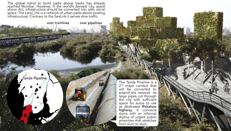
The Land_Link is perhaps the most spatially compelling element of the proposal. It transforms underutilized space above existing infrastructure, including rail lines, pipelines, and highways, into elevated parks and pedestrian paths. A rendering shows a vegetated linear corridor crossing above rail tracks and large industrial pipelines, its planted surface creating a green datum line that stitches together neighborhoods previously separated by impassable infrastructure. Unlike the city's high-speed expressways, Land_Link prioritizes slow mobility, walkability, and social interaction.
These green corridors serve a dual function: they provide new public space in a city chronically short of it, and they alleviate congestion on the streets below by drawing pedestrian and cyclist traffic up to a dedicated level. The modular design allows gradual expansion, integrating with existing infrastructure rather than replacing it. In a city where every square meter is contested, building on top of what already exists is not just clever; it is the only viable path forward.
Heart of Mumbai: Where Systems Converge and Public Life Takes Root
At the city's geographic center, the Heart of Mumbai acts as a metropolitan anchor where Sky_Ride loops and Land_Link corridors converge. It is designed not merely as a transit interchange but as a generator of civic life, incorporating mixed-use development, cultural spaces, and public amenities. The concept embodies the project's title literally: by placing a gravitational center equidistant from Mumbai's sprawling edges, it creates a destination that reconnects periphery with core.
The strategic logic is sound. A network without a focal point remains abstract; a hub without a network is isolated. By designing both simultaneously, Meet-in-the-Middle ensures that efficient transit interchange and vibrant public life reinforce each other. The hub becomes the place where the system's various users, from daily commuters to weekend visitors, physically share space and, in doing so, begin to repair the social fragmentation that decades of car-centric planning have produced.
Why This Project Matters
Meet-in-the-Middle matters because it refuses the false choice between density and livability. Mumbai's 15 million daily walking trips represent an enormous latent demand for pedestrian infrastructure, and this project takes that demand seriously. By layering cable cars, elevated green corridors, and a central hub onto the city's existing framework, it proposes a scalable system that can expand incrementally rather than requiring a single, politically improbable megaproject.
More importantly, the project reframes who urban transit is for. Rather than catering to automobile owners or long-distance commuters, it invests in the average walker, the cyclist navigating industrial buffer zones, the resident of Dharavi whose nearest transit node might as well be in another city. That shift in priority, from speed to accessibility, from throughput to equity, is the kind of reorientation that urban planning in the Global South urgently needs. B.N.P MARS and Duval Annabelle have articulated it with clarity and spatial intelligence.
View the Full Project
About the Designers
Designers: B.N.P MARS, Duval Annabelle
Enter a Design Competition on uni.xyz
uni.xyz runs architecture and design competitions year-round that reward proposals with spatial conviction and real site intelligence.
Project credits: Meet-in-the-Middle by B.N.P MARS, Duval Annabelle.


Popular Articles
Popular articles from the community

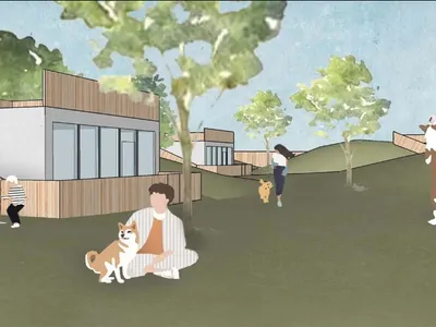
Temporary Home for Dogs: A Reversed Zoo Rethinks Animal Shelter Architecture
In Bucharest, a sinuous corridor and freed landscape flip the logic of containment, designing a shelter that works to make itself unnecessary.
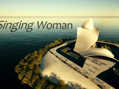
Singing Woman: An Opera House That Performs Before the Curtain Rises
Ovidiu Cristian Pavel's conceptual opera house translates Estonia's choral identity into a sculpted waterfront landmark facing the Baltic Sea.
The Amber Palace Opera: A Geological Fiction Surfaces on Tallinn's Baltic Waterfront
Pierre Brillard reimagines a Baltic legend as a public landscape, opera house, and waterfront promenade rooted in Tallinn's coastal identity.
Faces of the Soviet Avant-Garde: Turning Moscow's Street Names into an Open-Air Museum
A network of sculptural installations across a Moscow residential district transforms forgotten architect names into spatial encounters with cultural memor

Similar Reads
You might also enjoy these articles

Play: Fragments of Their World: Remembered Architecture Rebuilt as a Modular Playground for Refugee Camps
Tom Gardner abstracts domes, arches and towers from the homelands of displaced families into a kit of child-scaled play parts for camp settlements.
REBIRTH: A Circular Settlement Where Afghan Widows and Their Children Rebuild Life Together
A shortlisted Resile entry turns the circle into a protective ring of timber and brick, gathering homes, classrooms and gardens around a shared landscape.
The Main Dream: A Recycled Plastic Kit That Lets Refugee Children Build Their Own Playground
Thirty-centimetre interlocking cubes that connect on three axes turn play into construction, letting children author the spaces they occupy.
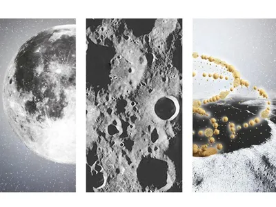
Lunar Spiral: A Fibonacci-Driven Moon Settlement Rising from Shackleton Crater
Golden-spiral geometry organises buried infrastructure and orbiting habitable spheres into a lunar base designed to grow as life on the Moon expands.

Comments (0)
Please login or sign up to add comments
No comments yet. Be the first to comment!