
Gustavo González Galarza Rebuilds a Devastated Ecuadorian City Center as a 10-Hectare Wetland Park
Las Vegas Park in Portoviejo reclaims abandoned river meanders and earthquake rubble to create a resilient civic landscape.

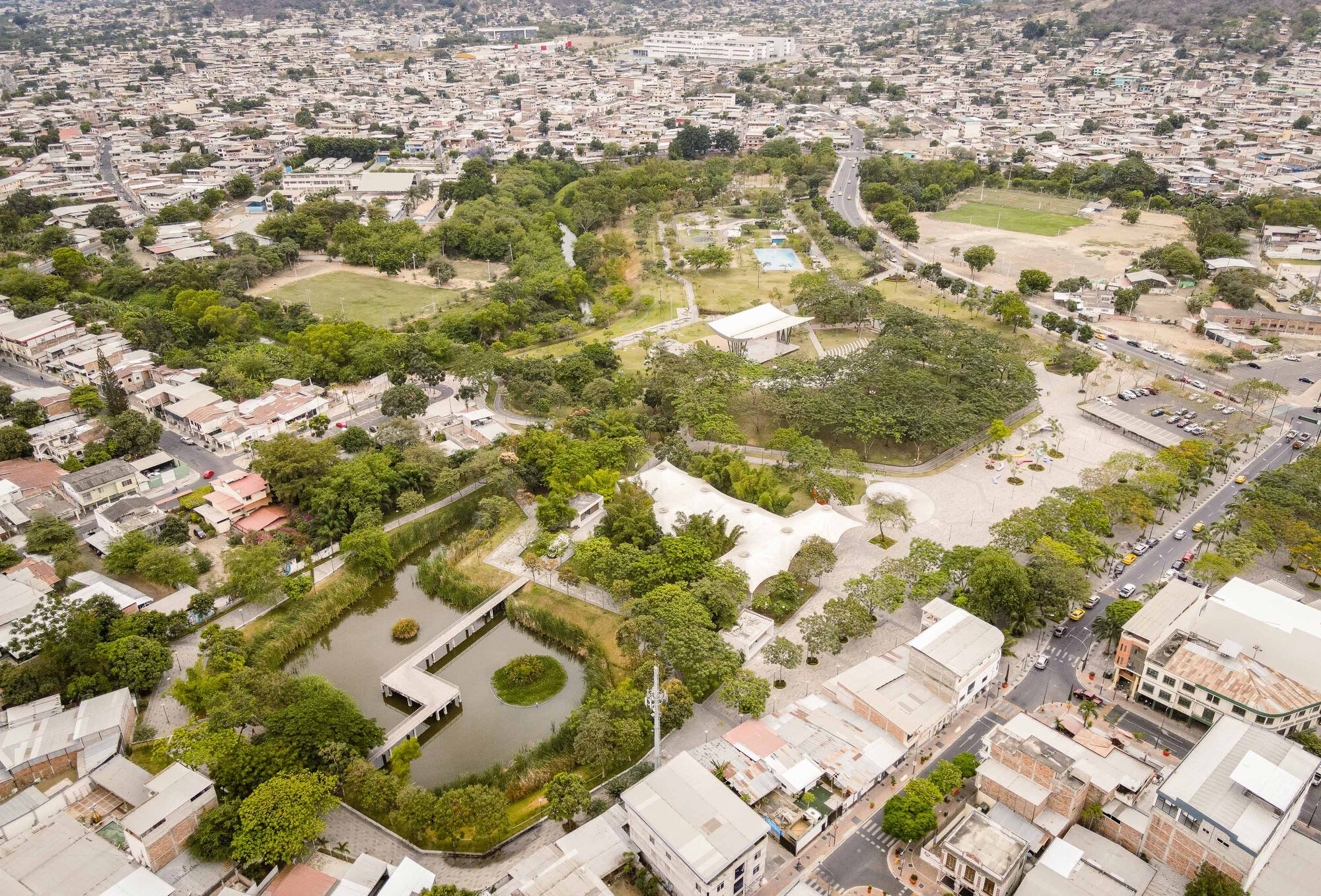
Two years after a magnitude-7.8 earthquake leveled much of Portoviejo in April 2016, the city opened a 107,000-square-meter park on some of the most geologically compromised land in its center. Las Vegas Park, designed by Gustavo González Galarza, sits on the right bank of the Portoviejo River atop old meanders with high liquefaction potential, ground too unstable for vertical construction but ideal for a landscape that can absorb, flex, and flood. At a cost of $7.2 million, the project employed roughly 400 people during construction, functioning as both an economic engine and a psychological signal that the city was reassembling itself.
What makes the project genuinely interesting is the refusal to treat a park as decoration. The site had been repeatedly filled over the decades, choking the river channel and amplifying flood risk. González Galarza reversed the process: the fill was excavated, the material was recycled into a 10-meter-high artificial hill, and the original depression left behind by a meander formed during the 1998 El Niño was regenerated as a 6,000-square-meter wetland. The park is not a green respite from the city so much as it is an infrastructural correction, one that simultaneously manages stormwater, restores riparian habitat, and gives Portoviejo the cultural and recreational spaces it lacked.
River, Meander, Wetland
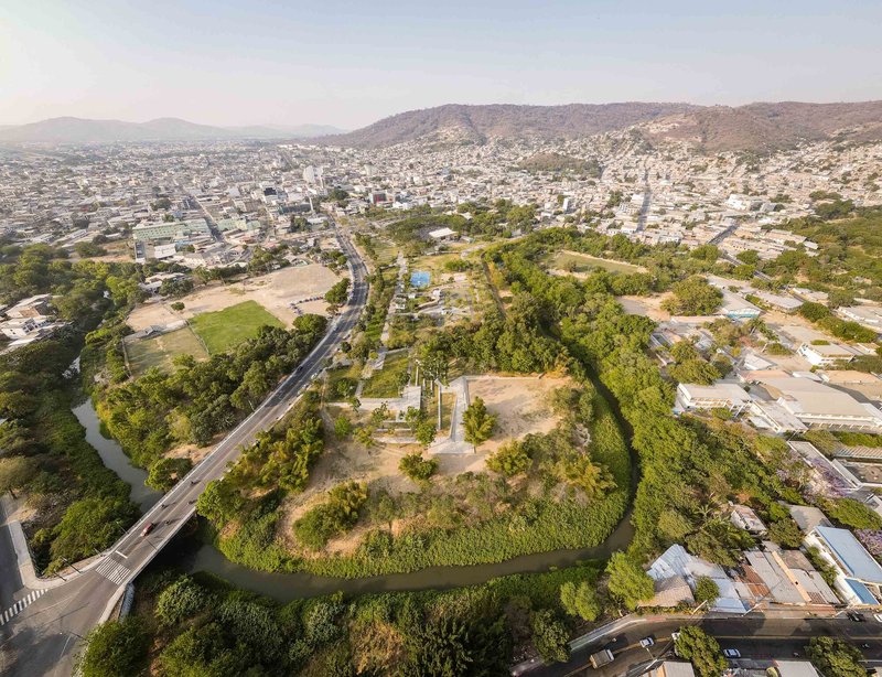
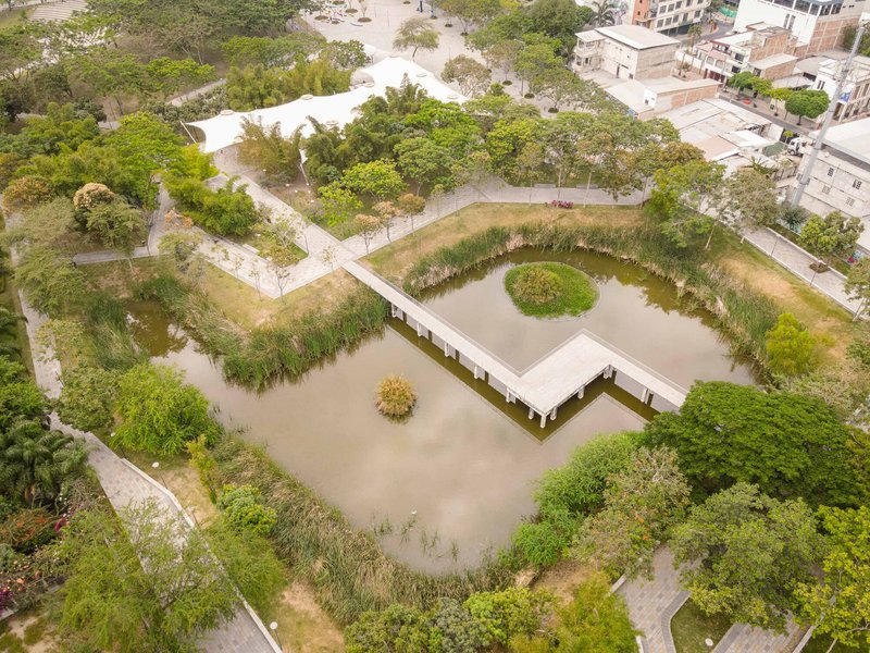
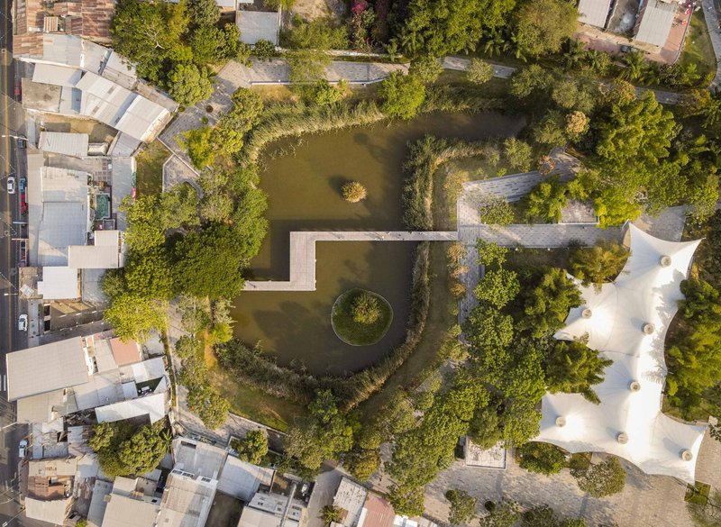
The aerial views make the logic legible. The park occupies a long strip between the river and the urban grid, its curving water basins tracing the ghost of a former meander. Geometric cross-shaped pools and circular islands lend formal structure to what is, functionally, a retention basin. Planted with juncos, lechuguines, papiros, and lotus flowers, the wetland is not sealed off from the river: proximity to the Portoviejo allows the pools to renew naturally, keeping the ecosystem dynamic rather than ornamental.
The 6,000 square meters of wetland absorb runoff from the park's hard surfaces, meaning infrastructure that would elsewhere be buried in pipes is here visible and participatory. You walk across it on elevated paths. You sit beside it. It is civic space and drainage system at once, an ecosystem-based adaptation strategy rendered as public amenity.
The Artificial Hill and the Amphitheater
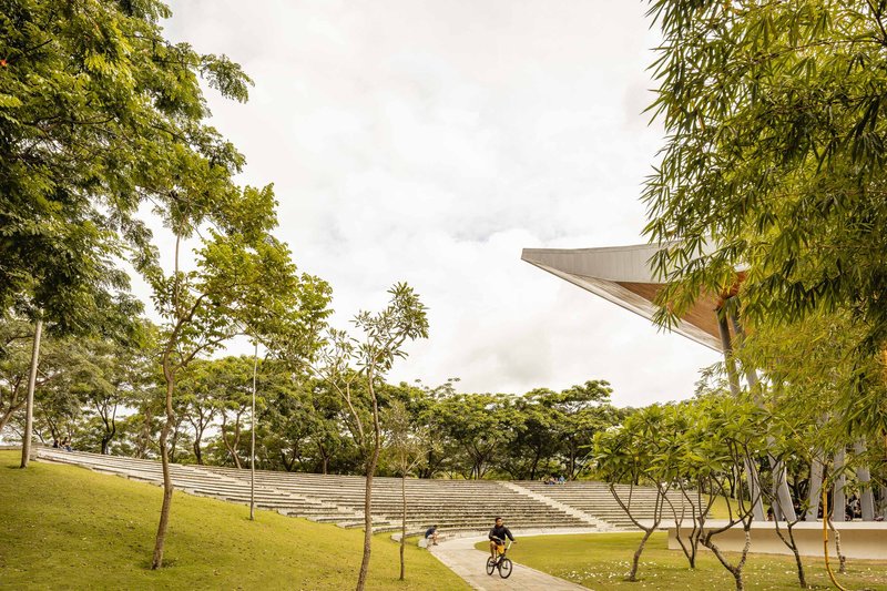
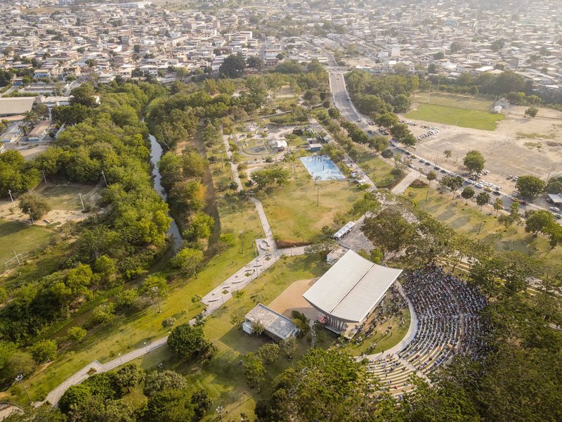
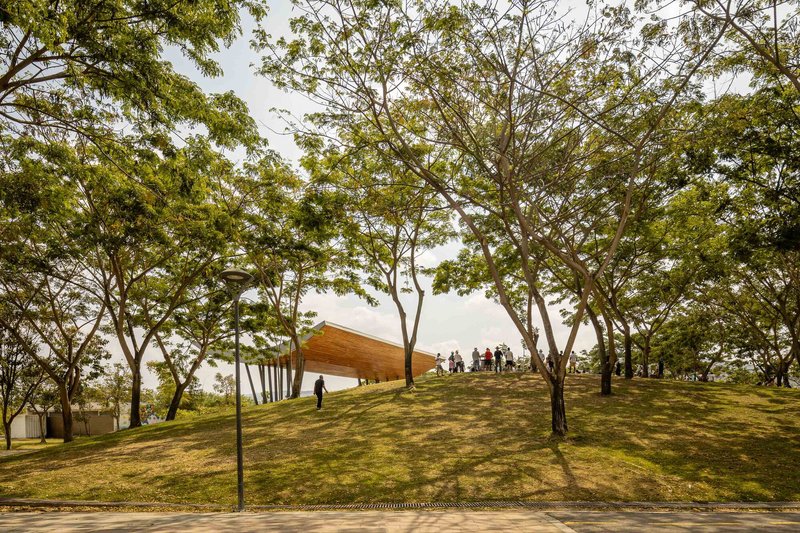
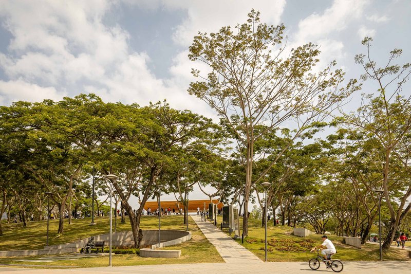
The most decisive move in the park is topographic. Filler material extracted from the river channel was reused to construct an 8,000-square-meter artificial hill rising 10 meters above grade. Enclosed within its forested slopes is an open-air amphitheater seating 2,000 spectators, complete with stage and dressing rooms. The hill absorbs the theater acoustically and visually, so that from the surrounding park you encounter a planted mound rather than an arena.
A timber-framed pavilion crowns one slope, visible through the tree canopy, giving the hill a small architectural event at its summit. The terraced concrete seating is clean and unadorned, framed by the trees planted across the earthwork. It is a cultural venue that Portoviejo did not have before the earthquake, built literally from the debris of the site's own geological mismanagement.
From Urban Plaza to Riverbank
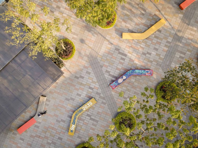
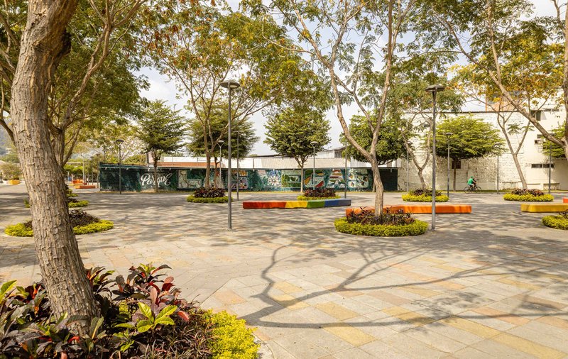
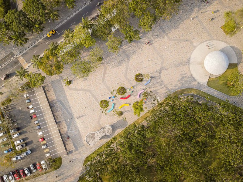
González Galarza organized the park as a spatial gradient. At the city-center entrance, hard-surfaced plazas with circular planting beds, orange benches, and formal geometry establish an urban register. Native huachapeli trees, chosen for their large canopy and regional provenance, rise from circular planters to moderate the microclimate over the pavement and modulate the scale of the plaza. The palette is restrained: concrete, painted steel, and the trees themselves.
A white spherical pavilion and multicolored seating elements add a pop of civic identity near the parking areas, but the design avoids spectacle. As you move toward the river, the surfaces soften, the tree cover thickens, and the programmatic density drops. The transition from urban activity to calm riparian edge is the conceptual spine of the entire project.
The Forest as Climate Machine
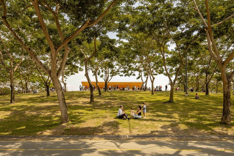
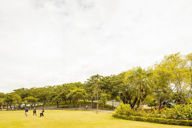
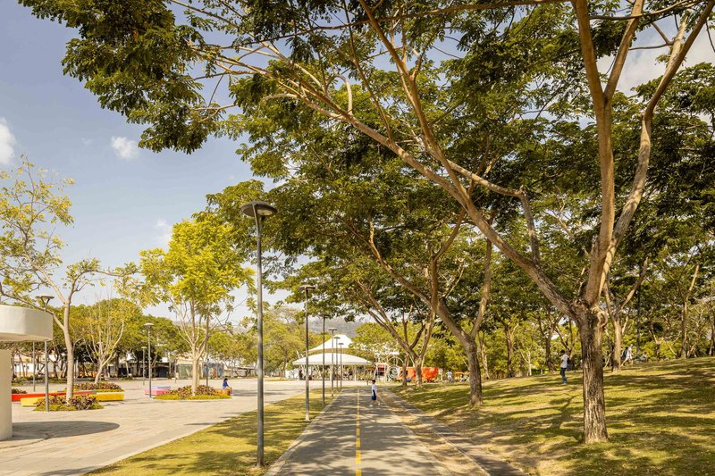
The photographs of families gathered beneath mature canopies tell a story that goes beyond shade. González Galarza planted forests of native and tropical species across the park not only for microclimate control but for a deliberate sensorial shift: different zones offer different forms, colors, sounds, and aromas as you move through them. Under the trees, temperatures drop, light filters, and the city recedes. In equatorial Ecuador, this is not a luxury; it is what makes a park usable.
The sunken lawn panels and winding pathways create a topographic intimacy beneath the canopy, channeling foot traffic along routes that feel discovered rather than prescribed. Children occupy the slopes and clearings with an ease that suggests the landscape was designed with their scale in mind.
Pavilions and Program
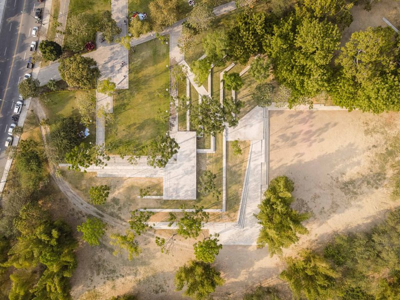
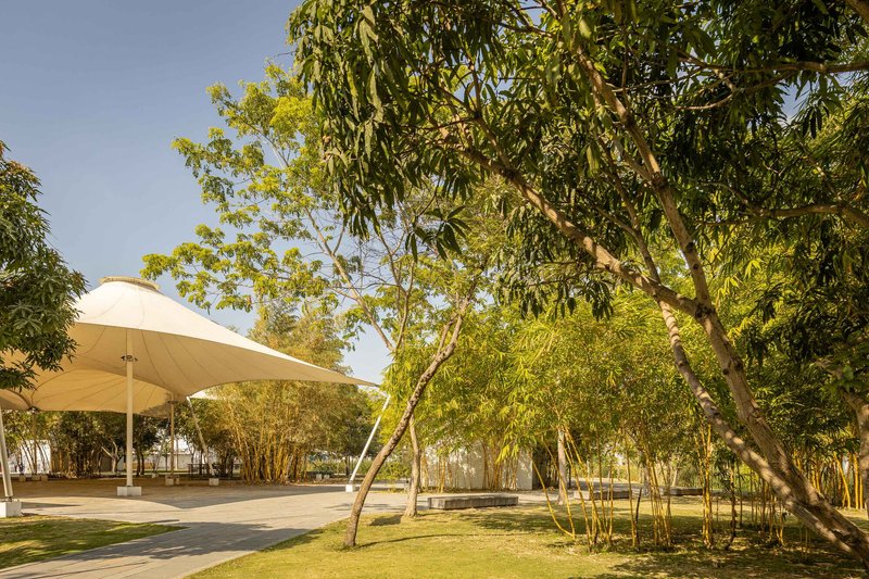
Architectural objects are distributed across the park with a deliberate lightness. A concrete pavilion with folded roof planes sits among lawn and trees, its angular geometry reading as a built counterpoint to the organic landforms. A curved canopy structure beside bamboo clusters serves as a gathering point. Kiosks, gazebos, and pergolas populate the edges of pathways. None of these elements tries to dominate the landscape; they serve it.
The program is broad: sports courts, a skate park, a children's playground, parking areas, and the amphitheater complex with its stage and dressing rooms. For a city that lacked cultural, tourist, and meeting spaces before the earthquake, this density of public programming on a single site is significant. That it was delivered for $7.2 million makes it remarkable.
Grounded Everyday Use
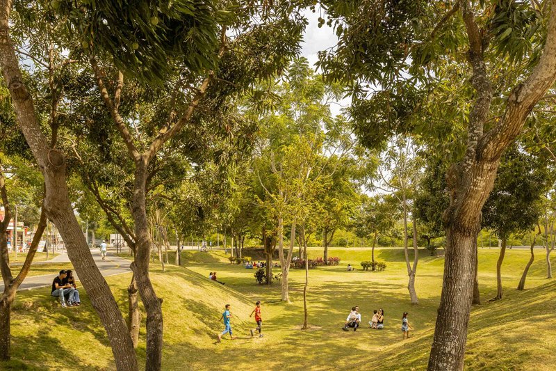
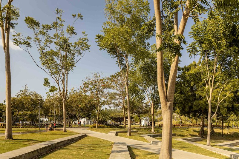
The late-afternoon photographs of children running across sloped lawns and cyclists passing through paved corridors document a park that is not precious about how it is used. The ground itself is the primary material: grass, earth, gravel, and concrete slabs arranged to accommodate spontaneous occupation. Newly planted trees alongside mature specimens suggest a park designed to improve with time, its canopy thickening and its wetlands maturing over decades.
Plans and Drawings
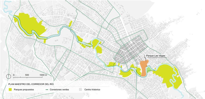
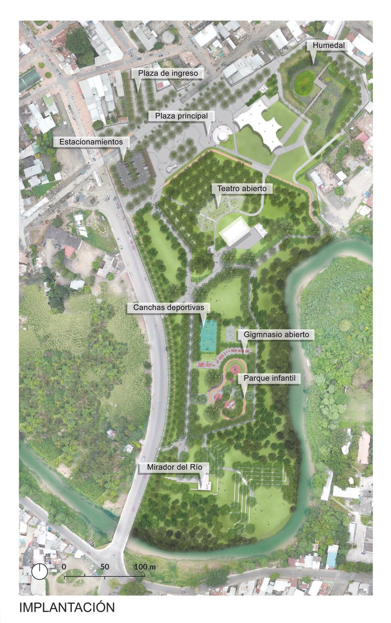
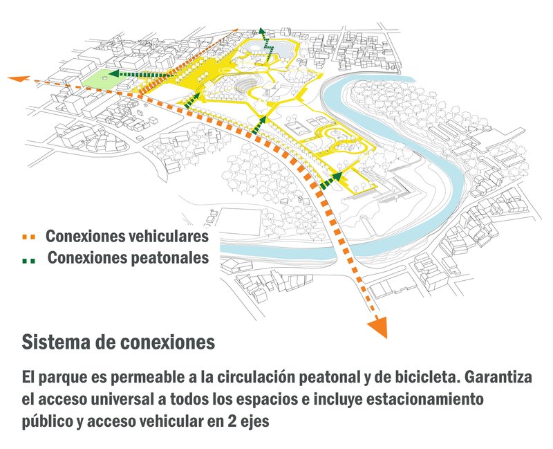
The master plan drawing reveals that Las Vegas Park is not an isolated gesture. It is part of an interconnected system of parks and nature reserves identified in the Portoviejo River Corridor Master Plan, a green infrastructure strategy that threads public space along the river through the urban fabric. The site plan shows how vehicular and pedestrian circulation routes weave through the park, connecting surrounding neighborhoods to the riverfront.

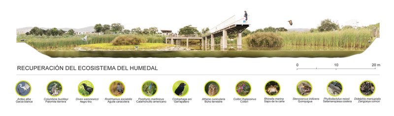
The section drawings are the most revealing documents. One cuts from the urban center through the plazas, across vegetated slopes, and down into the wetland and river, making the full topographic gradient legible in a single line. Another renders the wetland ecosystem in cross-section, illustrating native grasses, water levels, pavilion structures, and even the biodiversity expected to return below the surface. These are not decorative sections; they are ecological arguments.
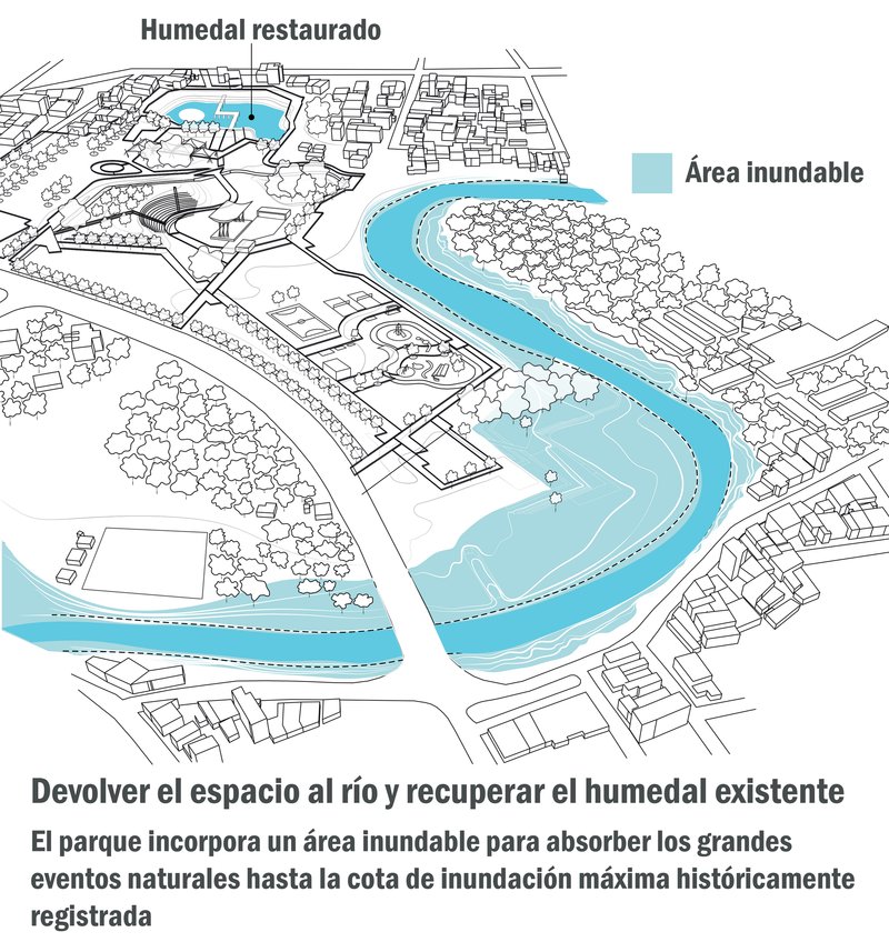
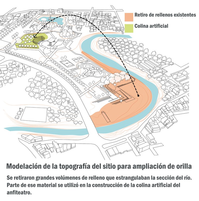
The axonometric diagrams articulate the two key landscape operations. One shows the restored wetland and floodplain zones along the meandering river, clarifying how the park's edges are designed to flood safely. The other illustrates the topographic exchange that defines the project: fill removed from the river channel and piled into the artificial hill, a simple earthwork transaction that simultaneously reduces flood risk and creates a cultural venue.
Why This Project Matters
Las Vegas Park is a case study in turning catastrophe into calibration. Rather than rebuilding what the earthquake destroyed, González Galarza recognized that the land itself had been damaged long before 2016, choked by decades of fill that narrowed the river and heightened flood exposure. The park's design reverses that damage while simultaneously addressing the cultural deficit that characterized pre-earthquake Portoviejo. The wetland, the amphitheater, the forested slopes, and the urban plazas are not separate features but components of a single corrective operation.
For architects and landscape designers working in disaster-recovery contexts, the project offers a clear lesson: resilience is not a layer added on top of design but the logic that generates form. Every major gesture in the park, from the excavated meander to the recycled-fill hill, performs double duty as both risk mitigation and public amenity. At a cost of roughly $67 per square meter, it demonstrates that ecosystem-based adaptation is not only ecologically sound but economically viable, and that the most powerful post-disaster symbol a city can produce is not a monument but a landscape that works.
Las Vegas Park by Gustavo González Galarza, Portoviejo, Ecuador. 107,000 m². Completed 2018. Photography by Carlos Palacios.
About the Studio
Share Your Own Work on uni.xyz
If projects like this are the kind of work you want to make, uni.xyz is a place to publish your own, find collaborators, and enter design competitions.



Popular Articles
Popular articles from the community

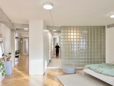
RDTH architekti Rips Out Nearly Every Wall in a Prague Apartment and Replaces Them with Furniture
A 101-square-meter post-war flat in Prague trades rigid partitions for a single rotated furniture block, curtains, and glass concrete.
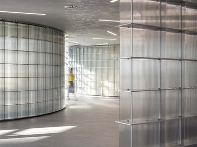
HCCH Studio Wraps a Shanghai High-Rise Office in Curved Walls of Translucent Glass
A 1,000 square meter fit-out in Lujiazui replaces the typical tech-office palette with layered glass, micro-cement, and quiet rigor.

20 Most Popular Office Building Projects of 2025
From biophilic workspaces in India to net-positive energy offices in New Delhi, 20 office building projects that defined architecture in 2025.
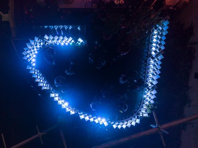
Rojkind Arquitectos and Think Parametric Build a Glueless Pavilion from 67 Interlocking Panels
A serpentine fiber-cement installation in Chapultepec Park celebrates a decade of architectural media in Mexico City.


Similar Reads
You might also enjoy these articles

127af Flips a Tiny Bagnolet Rowhouse Upside Down with a Handcrafted Roof Extension
A 55-square-meter terraced house on the edge of Paris gains a luminous upper living floor through lightweight timber and steel.
1.61 Design Workshop Wraps a 600-Square-Meter Café in Vietnam in Sculptural Burgundy Drama
Reden Café & Bistro pairs a helical staircase, mosaic floors, and deep red interiors to rethink Vietnamese hospitality space.
The Unbound Brain: A School Shaped by Cognitive Architecture
Cylindrical learning pods radiate like neurons from a central cortex, turning the floor plan into a spatial model of human thought.
Revival Vernacular Architecture: Rammed Earth Settlements for the Sahara
A modular desert community in Mauritania that fuses passive cooling techniques with earthen construction and local craftsmanship.


Explore Architecture Competitions
Discover active competitions in this discipline




The International Standard for Design Portfolios


The Global Benchmark for Architecture Dissertation Awards


The Global Benchmark for Graduation Excellence

Challenge to reimagine the Iron Throne
Comments (0)
Please login or sign up to add comments
No comments yet. Be the first to comment!