
LIVING LEDGES
A living place
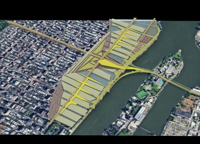
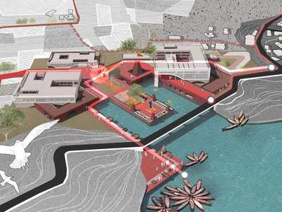
The Ledges adapt new systems for sustainable living by acting as a sanctuary for the development of wildlife ecosystems and small-scale agriculture. The proposed network of layered infrastructure blends accessible public and non-vehicular transportation with larger highways that seek to bridge the eastern coast of Manhattan to Roosevelt Island and West Queens. The almost crystalline urban housing development is integrated with submarine building tectonics that form artificial coral reefs that adapt to the needs of biological life using artificial intelligence.
Rosevelt Island is on a 100-year floodplain that was devastated by superstorm Sandy in 2012. Using Salt marsh as a filling agent in the segmented foundation naturally mitigates flooding by soaking up water and breaking up incoming waves. In addition, Salt marsh is a natural resource for indigenous ecosystems such as crustaceans, reptiles, and fish that have been in decline. Excess nitrogen from wastewater has caused the salt marshes in the area to grow shallow root systems which keep them from doing their natural job. Placing salt marshes into environmentally controlled cages will scrub the water of nitrogen and allow them to grow robust root systems. Using salt marsh as a building tectonic will help to reintroduce this natural resource to the area.
The observation of wildlife over time provides an ever-evolving characteristic of the place, allowing for the changing of seasons to transform the infrastructural use. As residents may stay mostly constant throughout the year, they will be made aware of the growth, settling, and migration of wildlife that fluctuates with temperature. Behind the artificial reefs lie water intake reservoirs which mechanically filter and chemically purifies water with the guidance of artificial intelligence. Sanitation reservoirs provide a circular system of water usage that supplies housing units with clean water, recycles wastewater, and filters debris from ocean water.
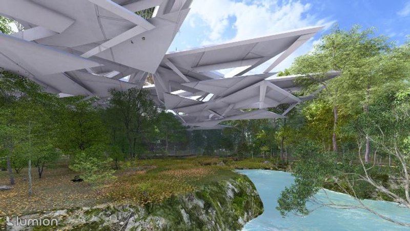
Large fanning planes project over the water to house dense layers of vegetated surfaces used to farm agriculture, sustained by an integrated irrigation system that syphons water from the reservoirs below and turns bio waste into farming compost. These vegetated shelving planes can be used as open green spaces, suspended farmland, or wildlife sanctuaries. The program includes a research analysis hub, which monitors the conditions of the ecosystems to further track the successes of environmental factors. However, residents are encouraged to advance their own understanding of these ecosystems via underwater viewing chambers suspended beneath the essential living quarters. In addition, the proposed subway shall run underwater beneath the bridging highway to expose panoramic views of the underwater sanctuary.
Public transportation routes are accompanied by a network of green belts that are suspended over wildlife habitats, and tributaries into large triangular depressions that support a series of public parks and commercial interventions. By championing more subtle means of transportation such as cycling, foot traffic, or train, the development is able to significantly reduce its carbon footprint while providing convenient transitional avenues free from high speed vehicles which run high above. The highway is accessible through small scale on-ramps to merge on a short runway. The bridge terminates at a proposed civic center that contains a subway station, welcome center and museum of wildlife history. This piece of program will complement the adjacent parks on Roosevelt Island, making a stretch of greenway that coalesces at points of commerce and interest.
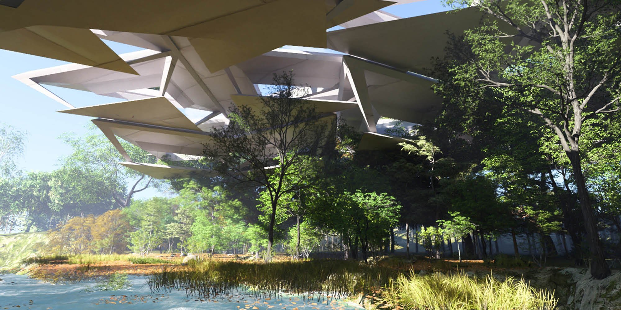
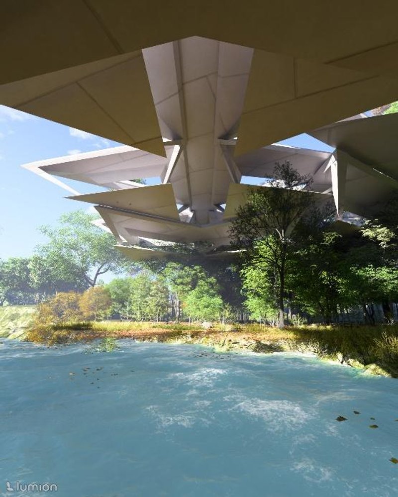
These depressions are referred to as cirques, which make up one of the three spatial typologies used to construct the residential block. The crystalline appearance of the building tectonics lead to a conversation of materiality, and furthered with analysis of ice formations. This brought about the use of three spatial typologies which are cirque, glacier, and moraine. Glaciers are used as spacious dwellings for housing units and programmatic events, moraines (which are long ridges formed by runoff from glaciers) are used as transitory spaces with the opportunities for panoramic views, and cirques (which are large crater like depressions caused by glacial erosion) as stated above. The bridging elements as well as other spatial structures are made from mostly cast in place concrete, and inlaid with long spans of tinted glazing. Smart glass, which becomes opaque when activated by an electric current, is implemented on the lower levels of the residential dwellings to promote privacy and temporarily disguise the notion of being submerged underwater. Long spanning moraines are fastened with fibrous material that supports the root systems of vines and moss which coat the exterior roof tops for thermal protection.

Popular Articles
Popular articles from the community
Takeshi Hosaka Architects Suspends a Concrete Cross Above a Yokohama Cemetery
A 28-square-meter burial renovation in Yokohama lifts the symbol of resurrection into the sky so mourners see it against heaven.
RDTH architekti Rips Out Nearly Every Wall in a Prague Apartment and Replaces Them with Furniture
A 101-square-meter post-war flat in Prague trades rigid partitions for a single rotated furniture block, curtains, and glass concrete.
Rojkind Arquitectos and Think Parametric Build a Glueless Pavilion from 67 Interlocking Panels
A serpentine fiber-cement installation in Chapultepec Park celebrates a decade of architectural media in Mexico City.
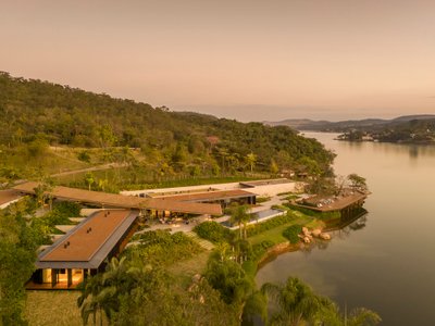
Bernardes Arquitetura Stretches a Timber Roof Along a Reservoir's Edge in Minas Gerais
Dam House in Itaúna lets a sweeping wooden canopy dissolve the boundary between hillside terrain and open water.

Similar Reads
You might also enjoy these articles
The Rhythm of Seasons
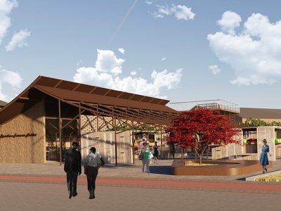
A Farmers' Market Connecting Nature and the City
More Than a Building-Designing a Living System
More Than a Building-Designing a Living System
Base Beyond
DESERT COMPOUND ARID: TOURISM OF ABSENCE AND ABUNDANCE
From Myth to Matter
Rejuvenating the flowing sanctity of panatirtha: Enhancing the natural and cultural tourism of panatirtha, tahirpur through architectural and planning intervention
Explore Architecture Competitions
Discover active competitions in this discipline


The International Standard for Design Portfolios

The Global Benchmark for Architecture Dissertation Awards

The Global Benchmark for Graduation Excellence

Challenge to reimagine the Iron Throne
Comments (0)
Please login or sign up to add comments
No comments yet. Be the first to comment!