

Where Rock Meets River at Wuyi Mountain
CLAB Architects carves a 970 m² observation deck into the geological strata at the entrance to one of China's most celebrated national parks.
Moon Bay Waterfall is the first thing you see when you enter Wuyi Mountain National Park. It is the handshake, the threshold moment. So when CLAB Architects was asked to design an observation deck here, the stakes were unusually clear: whatever they built would frame every visitor's first impression of a UNESCO World Heritage landscape. Getting it wrong would mean competing with the scenery. Getting it right would mean disappearing into it.
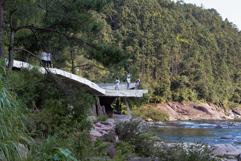
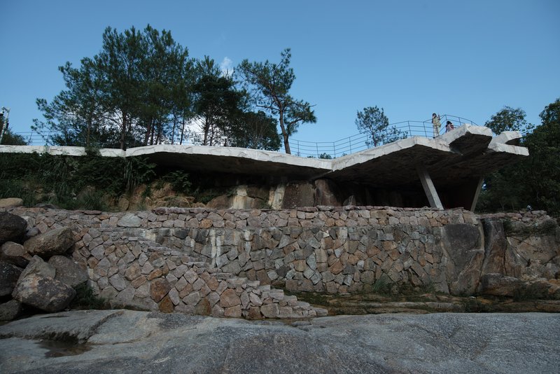
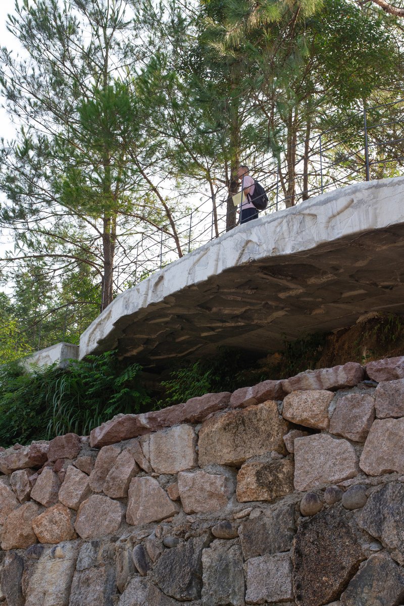
What the Rome and Shanghai based studio delivered in 2024 is a 970 m² intervention that reads less like a building and more like a geological event. Cantilevered concrete platforms emerge from stratified stone walls, hovering over the river on slim columns, their board-formed soffits mimicking the sedimentary layers of the rock face below. The project is landscape architecture in the most literal sense: architecture that behaves like landscape.
Reading the Strata
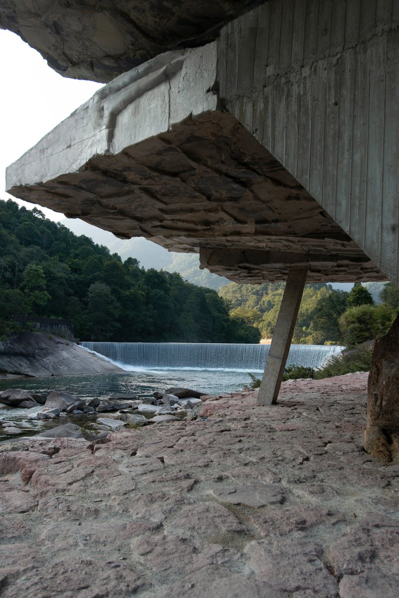
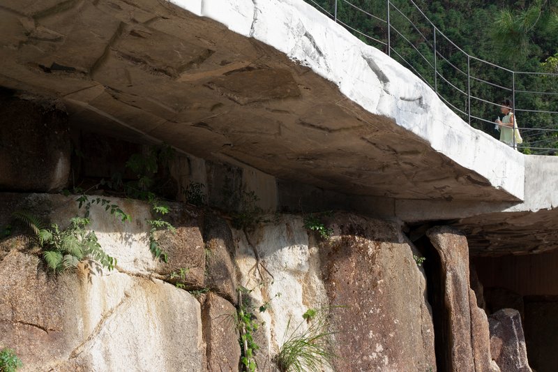
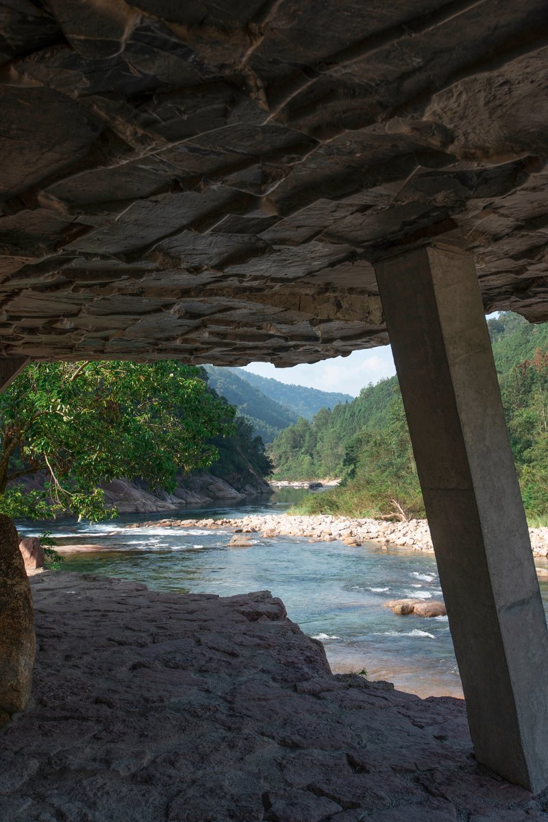
The most striking decision here is the refusal to separate structure from geology. Gabion and dry-stone retaining walls rise directly from the riverbank's exposed rock face, and the concrete roof slabs above them carry the same horizontal banding. Stand beneath the cantilevered overhang and you cannot immediately tell where the cliff ends and the architecture begins. Board-formed concrete textures on the underside of the slabs echo the sedimentary striations of the natural stone, while ferns and vines colonize the seam between the two.
The effect is geological mimicry without pastiche. CLAB is not trying to fake rock. The concrete is plainly concrete. But its grain, orientation, and layering share a language with the cliff, and that shared grammar is what makes the whole composition hold together.
The Cantilever as Viewfinder
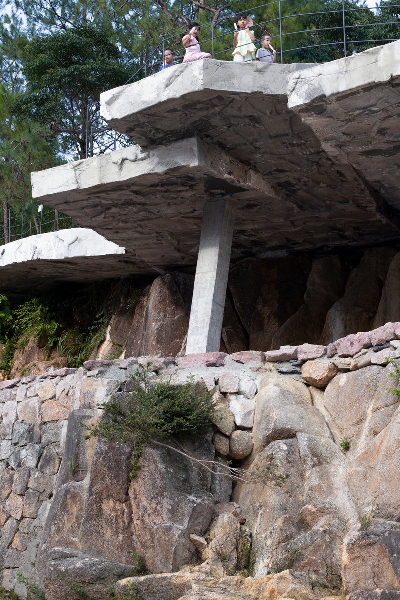
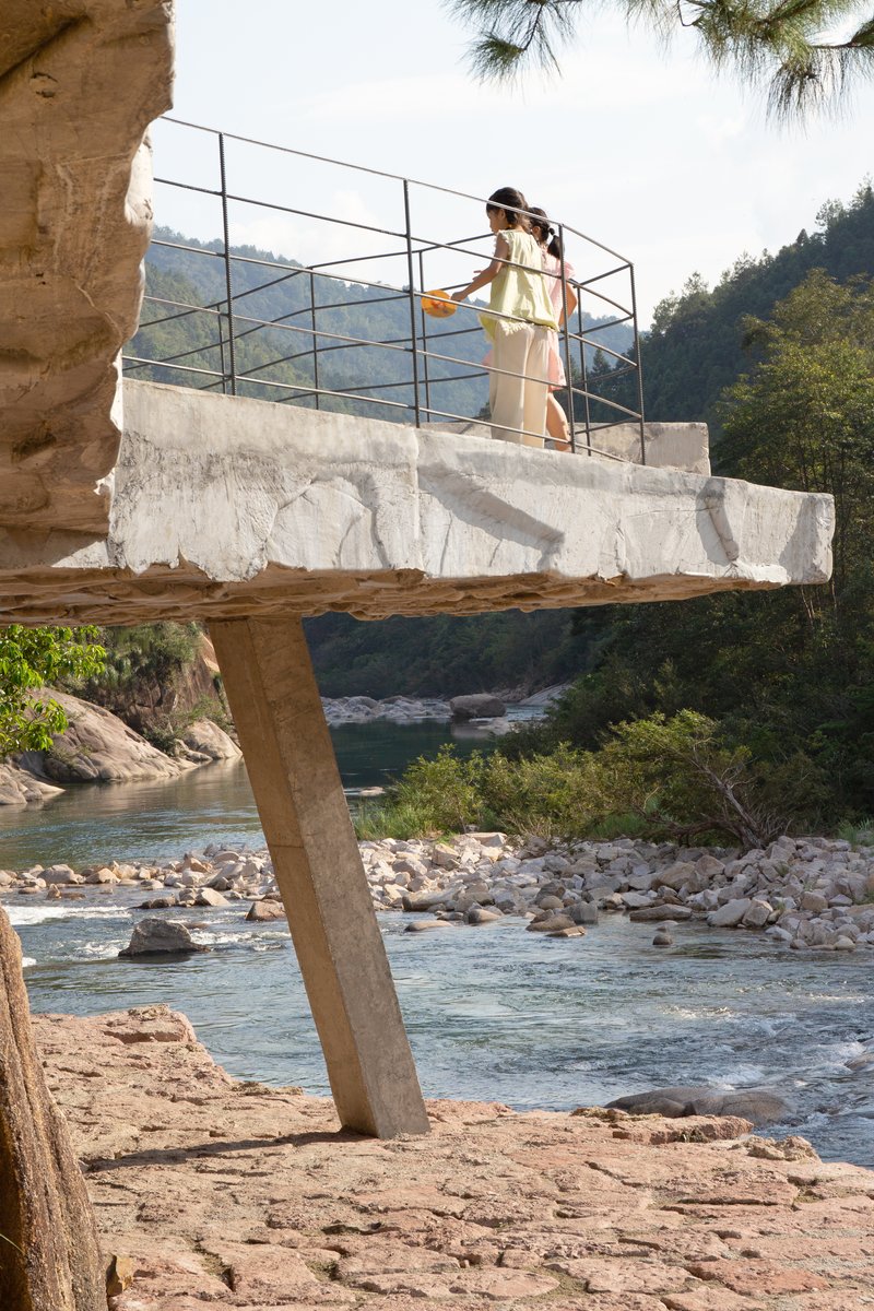
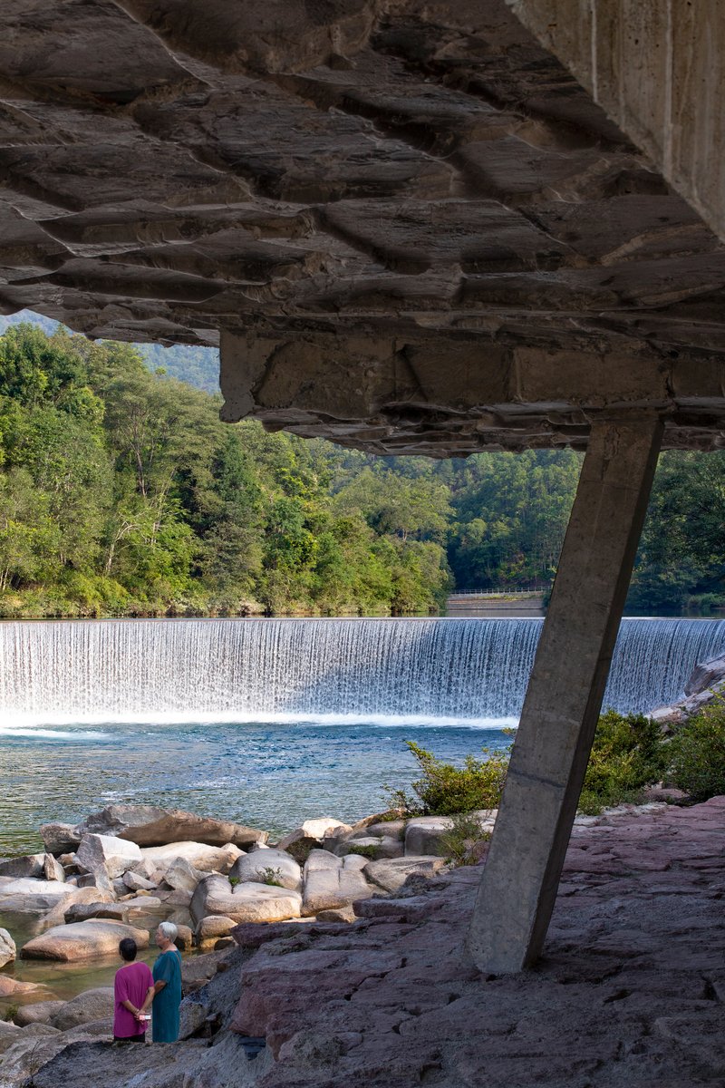
The deck's primary gesture is a series of cantilevered concrete platforms that push out over the river, supported by single columns planted among the boulders. These are not ornamental balconies. Each platform is angled to frame a specific view: the weir, the forested hillside, the river winding through the valley. The thinness of the slabs and the cable railings keep the visual mass low, letting the landscape dominate.
There is a quiet confidence in using a single column to hold a platform where visitors gather to photograph one of China's most visited natural sites. The structural clarity communicates trust, both in the engineering and in the viewer's intelligence. No theatrical flourishes, no swooping forms. Just a slab, a column, a view.
Moving Through the Site
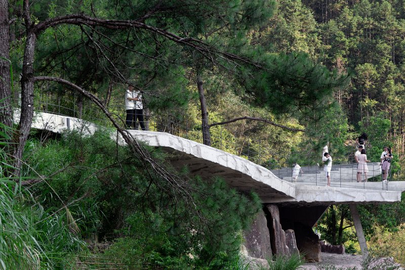
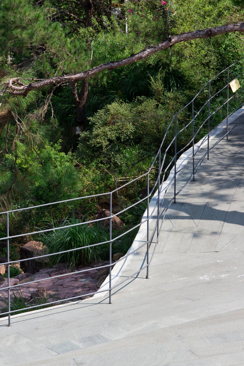
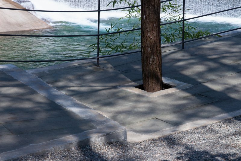
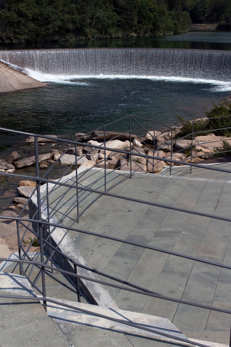
The project is not a single platform but a choreographed sequence of paths, bridges, and landings that guide visitors through the terrain. A concrete pedestrian bridge threads through pine forest. Curving walkways with steel cable railings descend through dense foliage. At one point, a tree trunk emerges directly through the paving, a detail that suggests the design was drawn around the existing vegetation rather than cleared to accommodate it.
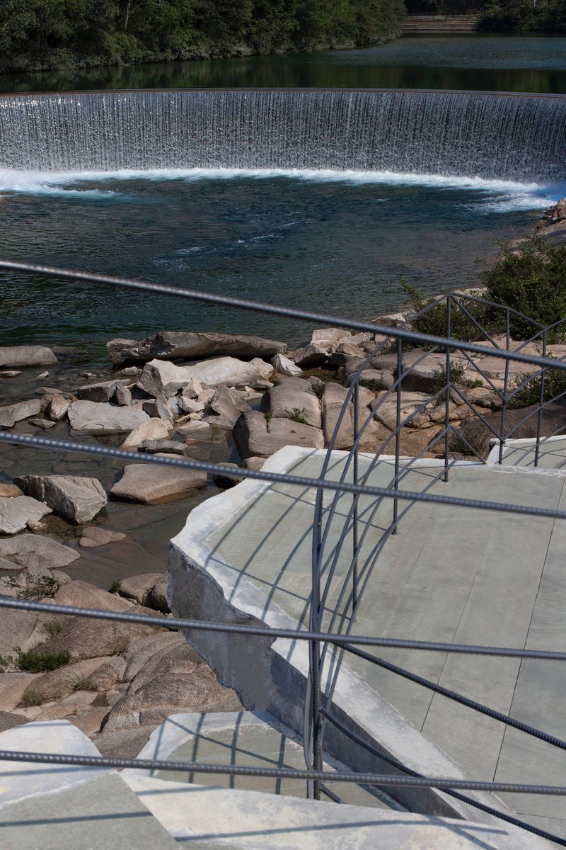
The circulation works on multiple levels, literally. Stairs cut down to rocky ledges beside the weir, while elevated walkways let you hover above the rushing water. The effect is immersive without being extreme: you are close to the river, close to the rock, but always on solid ground.
Stone, Concrete, and the Space Between
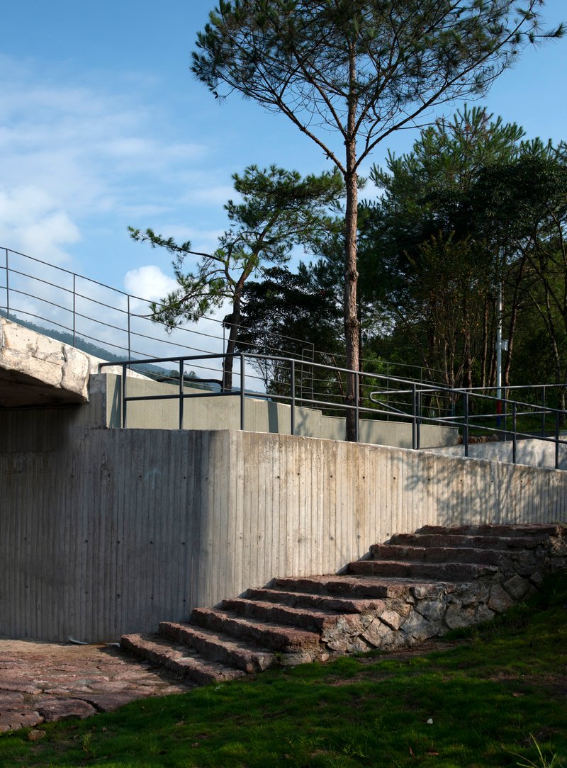
The material palette is ruthlessly limited: local stone, board-formed concrete, steel cable, and metal handrails. Nothing is painted, clad, or finished beyond what the formwork left behind. The gabion retaining walls use stone that could have come from the riverbed twenty meters away, and the concrete above them ages toward a similar grey. Over time, the distinction between old rock and new structure will continue to blur.
This restraint is the project's greatest strength. In a national park context, the temptation to overdesign, to create an Instagram landmark, is enormous. CLAB resists that pull entirely. The observation deck is a frame, not a subject.
Framing the Waterfall
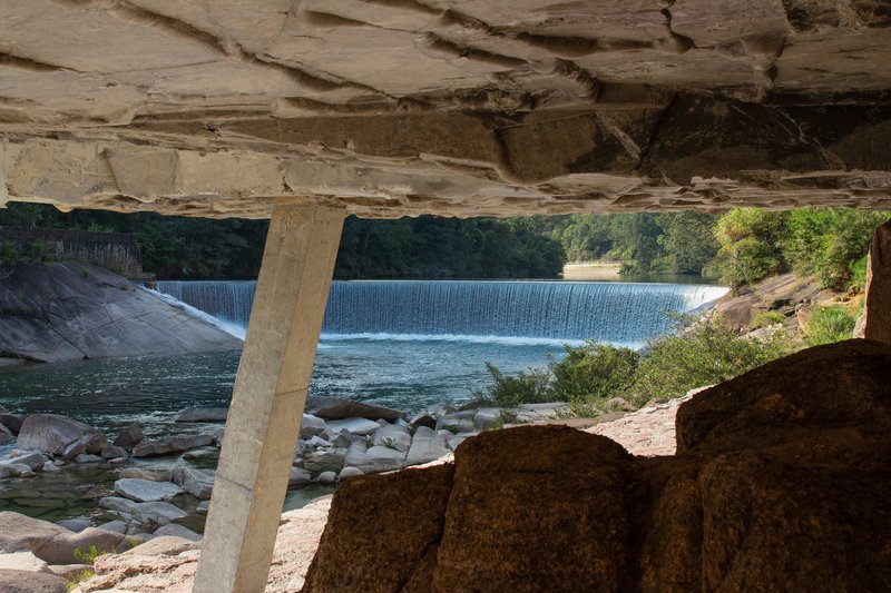
The most cinematic moments happen beneath the roof slabs, where concrete columns and stone walls create apertures that isolate portions of the cascading weir and distant mountains. Standing in these shaded voids, the river is compressed into a framed composition. The sound of falling water fills the space, amplified by the hard surfaces overhead. It is architecture doing what a camera lens does: selecting, cropping, directing attention.
The dam weir itself, a long horizontal cascade across dark water, becomes the visual anchor for the entire complex. Every stairway, terrace, and platform orients itself in relation to that white line of falling water. The geometry of the intervention follows the topography, but the experiential logic follows the sound.
Rooftop and River Level
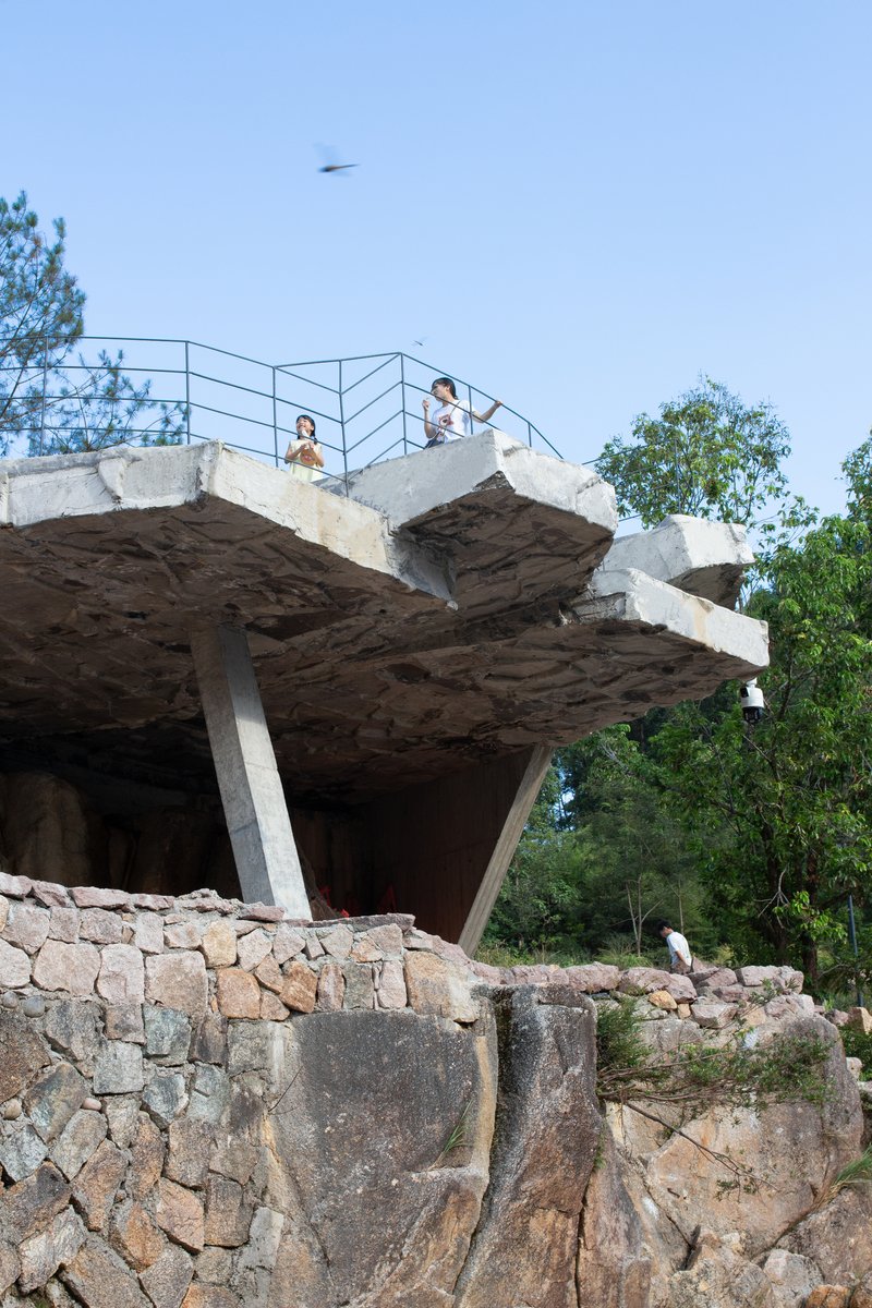
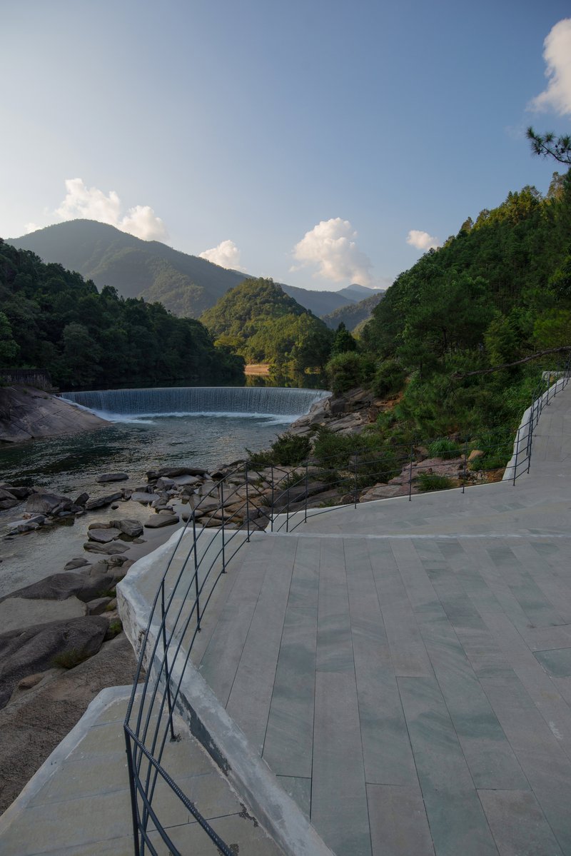
The vertical range of the project is significant for a structure of modest footprint. At its highest point, a rooftop observation deck offers a panoramic sweep across the canopy. At its lowest, concrete steps deliver visitors to rocky ledges at the water's edge. Between those extremes, a series of intermediate terraces and curving paved paths follow the riverbank's contour, each offering a subtly different relationship to the water.
The railing shadows cast across the stone paving on the stairways create their own geometry, a secondary pattern that shifts through the day. It is a small thing, but it suggests that the designers thought carefully about how sunlight would interact with the structure's angles, not just the views.
Plans and Drawings
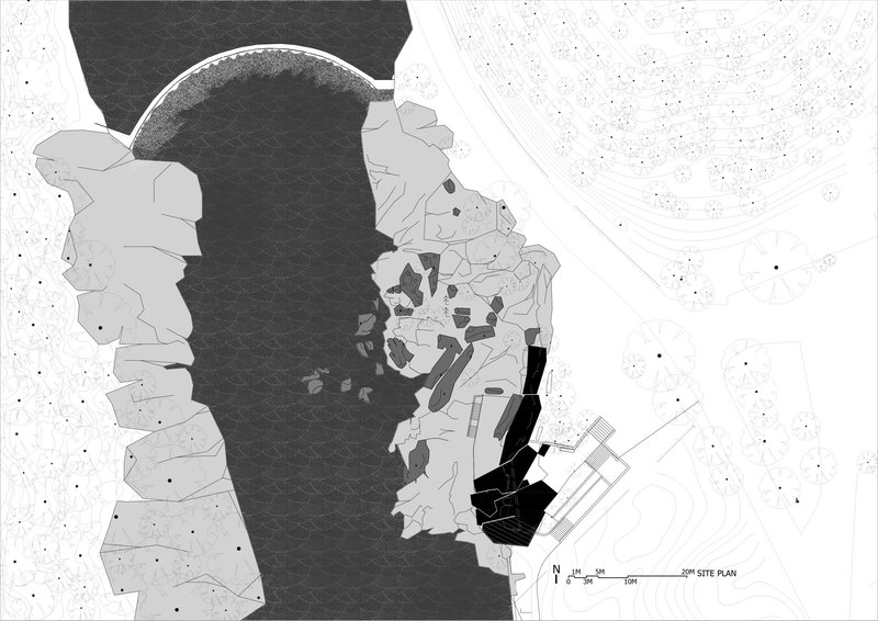
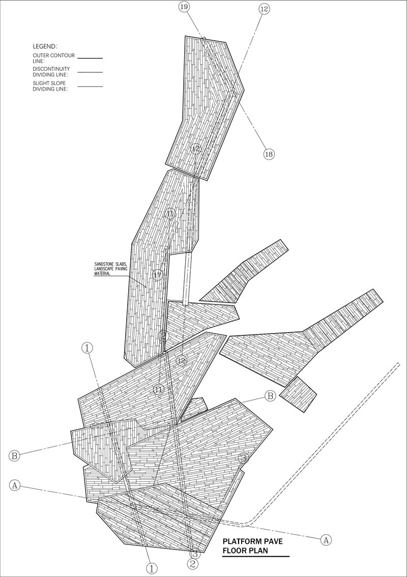
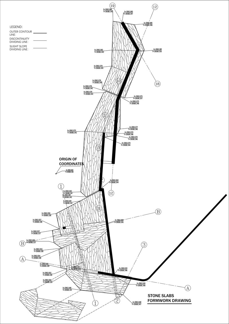
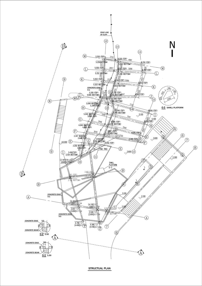
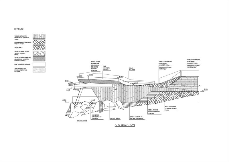
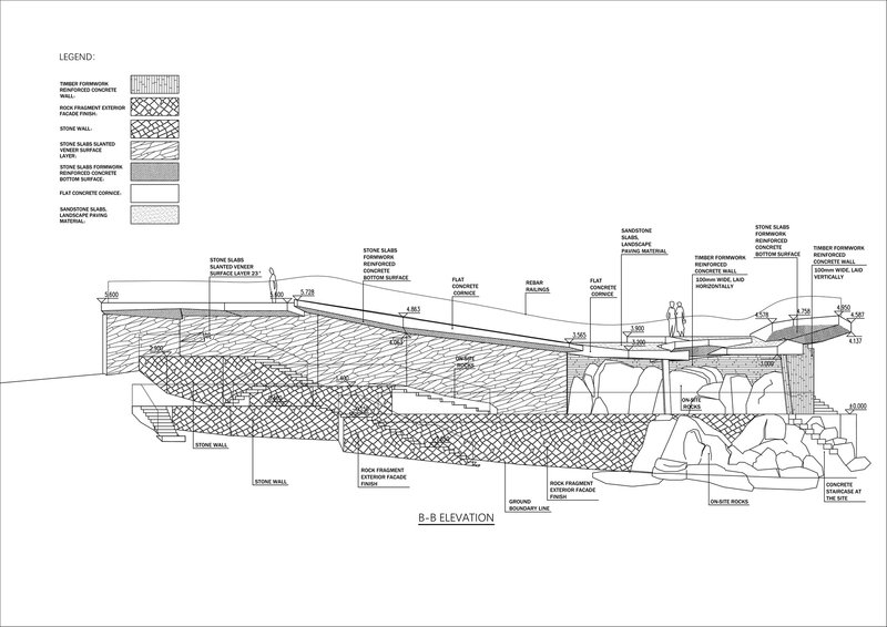
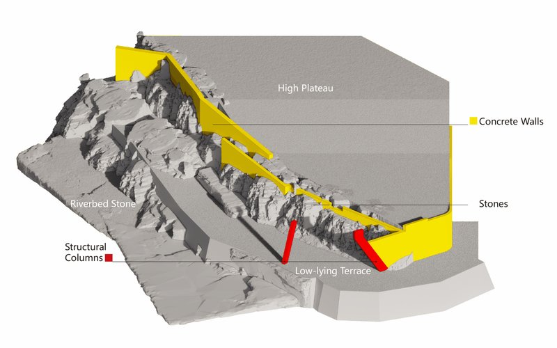
The site plan reveals just how precisely the intervention threads between the reservoir and the existing topographic contours. The angular paved surfaces in the floor plan register as a controlled explosion of geometry, facets rotating to align with sightlines rather than a Cartesian grid. Sections show the layered stone foundation supporting the sloped concrete roof, with material hatching making explicit what the photographs imply: a deliberate confusion of natural and constructed strata.
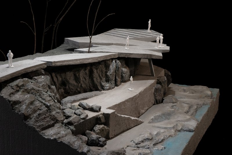
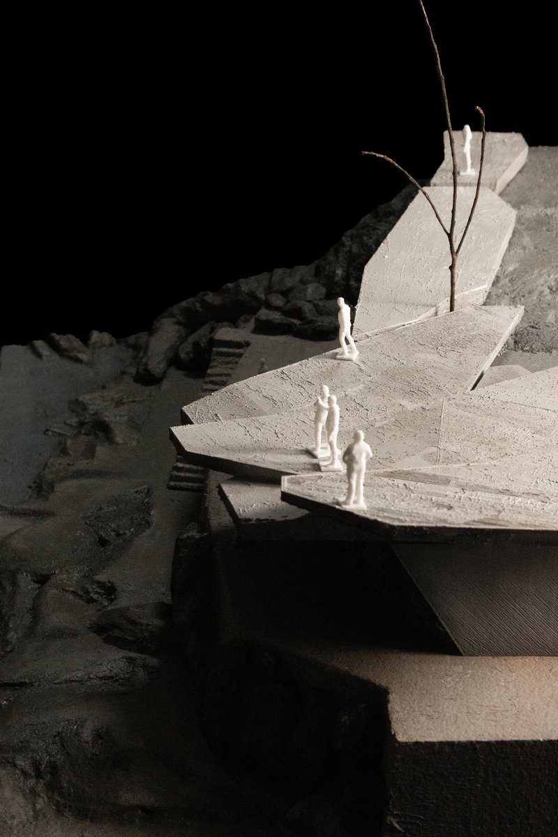
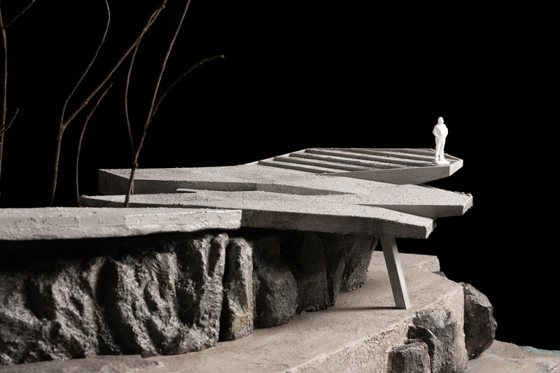
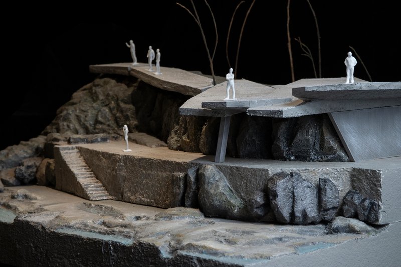
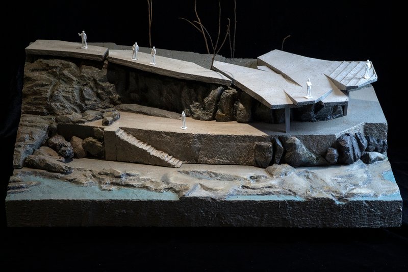
The axonometric diagram, which highlights concrete walls in yellow and structural columns in red, is particularly revealing. It exposes just how few columns carry the cantilevered platforms and how much of the apparent mass is actually retaining wall, not structure. The physical models, photographed against black, show the project as a kind of inhabited cliff: terraces and overhangs carved from the hillside with miniature figures providing an immediate sense of the scale at play.
Why This Project Matters
National park infrastructure projects in China have oscillated between two poles: invisible timber boardwalks that barely register and flamboyant glass skywalks designed to go viral. CLAB's Moon Bay Observation Deck charts a third course. It is undeniably present, a piece of architecture with spatial ambition and material conviction, yet it subordinates itself to the landscape it serves. The design does not demand your attention; it redirects it toward the waterfall, the valley, the rock.
The lesson is one worth restating: good landscape architecture is not about blending in or standing out. It is about building a relationship between a person and a place that neither could achieve alone. At Moon Bay, CLAB has built exactly that relationship. You stand on concrete, look through stone, and see the river as if for the first time.
Fujian Wuyi Mountain National Park Moon Bay Observation Deck by CLAB Architects (Lead Architect: Xu Lang). Nanping, China. 970 m². Completed 2024.
About the Studio
Share Your Own Work on uni.xyz
If projects like this are the kind of work you want to make, uni.xyz is a place to publish your own, find collaborators, and enter design competitions.


Popular Articles
Popular articles from the community
The Faith: Modular Architecture for Play, Learning, and Hope in Kutupalong Refugee Camp
A modular playground architecture project in Bangladesh where play, learning, safety, and hope rebuild childhood inside a refugee camp anew.
Milan Crossover: Sustainable Architecture for a New Fashion Culture in Milan
Milan Crossover transforms fashion culture through sustainable architecture, linking material libraries, remake studios, and public runways.
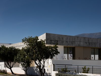
PLATAFORMArq Folds a Concrete Roof Over the Portuguese Mountains in House #474
A 220-square-meter residence in Teixoso, Portugal, wraps board-formed concrete into an angular canopy that frames the Serra da Estrela foothills.
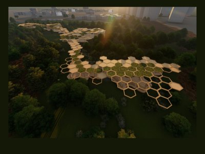
Eco Chapel: A Green Architecture Pavilion Designed in Symbiosis with the Forest
Eco Chapel uses green architecture to weave prayer, learning and reuse into a forest pavilion shaped by modular hexagonal canopies for life.


Similar Reads
You might also enjoy these articles
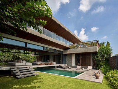
Freebird Residence by Alexis Dornier: A Tropical Modernist Sanctuary in Bali
Floating living pavilion above pool anchors H-shaped tropical villa, blending Japanese minimalism, sustainable strategies, lush landscape, and sculptural interiors.
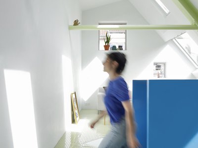
127af Flips a Tiny Bagnolet Rowhouse Upside Down with a Handcrafted Roof Extension
A 55-square-meter terraced house on the edge of Paris gains a luminous upper living floor through lightweight timber and steel.
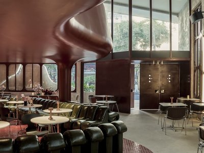
1.61 Design Workshop Wraps a 600-Square-Meter Café in Vietnam in Sculptural Burgundy Drama
Reden Café & Bistro pairs a helical staircase, mosaic floors, and deep red interiors to rethink Vietnamese hospitality space.
The Unbound Brain: A School Shaped by Cognitive Architecture
Cylindrical learning pods radiate like neurons from a central cortex, turning the floor plan into a spatial model of human thought.


Explore Landscape Design Competitions
Discover active competitions in this discipline


The International Standard for Design Portfolios


The Global Benchmark for Architecture Dissertation Awards


The Global Benchmark for Graduation Excellence


Challenge to reimagine the Iron Throne
Comments (0)
Please login or sign up to add comments
No comments yet. Be the first to comment!