


Urban Mobility
Design and architecture approaches to movement, transit systems, and livable urban spaces.
Urban mobility is the way people and goods move through a city, and the design of the networks that carry them: walking routes, cycle lanes, buses, trams, metros, rail and roads, together with the interchanges where they meet. For architects and planners it is less a question of vehicles than of access, of arranging land use, transit and public space so that daily trips are short, safe and possible without a car.
What is urban mobility?
UN-Habitat describes mobility as a fundamental urban basic service, one that shapes the spatial structure of cities and decides who can reach jobs, services and housing. That framing matters for designers. A new metro line, a cycle network or a car-free district changes which plots are valuable, where people choose to live and how long their days are.
Urban mobility works at the scale of the network and the system. It asks how modes connect, where interchanges sit, how far apart stops are, and how land use around them generates or removes the need to travel. It overlaps with several neighbouring fields on uni.xyz. The design of a single street section, its footways, trees and kerbs, belongs to streetscape. The architecture of stations and terminals is covered under transit hub, and walking as a citywide condition under walkable city. Mobility ties these together: it is the reason a station needs a good forecourt, and the reason a good street needs somewhere to go.
UN-Habitat frames the response through the Avoid, Shift, Improve approach: avoid unnecessary trips through compact, mixed land use; shift trips to walking, cycling and public transport; and improve the vehicles and systems that remain. Most design work in the field, from a bus stop to a regional plan, fits one of those three verbs.
A short history of urban mobility
Designers have long drawn cities around their means of transport. In 1882 Arturo Soria y Mata proposed the linear city, an elongated settlement organised in parallel bands along a railway, with wide roads separating vehicles, pedestrians and trams. It was an early attempt to make the transport line the spine of urban form.
The twentieth century reorganised cities around the private car, and the backlash shaped the profession. Jane Jacobs, as Project for Public Spaces recounts, became chair in 1962 of the Joint Committee to Stop the Lower Manhattan Expressway, a campaign often seen as one of the turning points in the development of New York City. Cities began to ask what a highway took away as well as what it carried.
The positive model came from Brazil. In 1974 Curitiba opened the Rede Integrada de Transporte, one of the first bus rapid transit systems in the world, with dedicated lanes, prepaid fares and raised tube stations for level boarding. It is also cited as one of the first and most successful examples of transit-oriented development.

Bogotá's former mayor Enrique Peñalosa gave the movement its best-known line, which UN-Habitat still quotes on its mobility page.
"A better city is not one where poor people drive cars, but one where rich people take public transport"
Enrique Peñalosa, former Mayor of Bogotá, quoted by UN-Habitat
The most recent turn is proximity. In 2016 Professor Carlos Moreno introduced the 15-minute city, in which daily needs sit within a short walk, bike ride or transit trip, and Paris mayor Anne Hidalgo made it part of her 2020 re-election campaign.
Key principles of urban mobility design
Build around transit, not beside it
Transit-oriented development puts homes, jobs and services within walking distance of frequent public transport. The Institute for Transportation and Development Policy describes its TOD Standard 3.0 as an attempt to move from complete streets to complete communities. The uni.xyz journal on Transitional Linkage by Zillur Rahman shows the principle at a dense node where an airport corridor, a railway station, a highway, a bus stand and new mass rapid transit lines converge, tied together at a single shared level.
Reuse the lines a city already has
Old railways, viaducts and ring roads are mobility assets waiting for a new use. Peripherique in Movement by Cem Ozbasaran, the most liked project in this topic and an Honorable Mention in the Salut Paris competition, starts from the Petite Ceinture, the orbital railway whose local passenger service closed in 1934, and extends along the beltway to create momentum for circular movement around Paris.

Join the modes at the hub
Most trips involve more than one mode, so the interchange decides whether a network feels like one system. The journal on Hosoya Schaefer Architects' Mobility Hub Zug Nord in Switzerland describes a 17,000 square metre structure at the threshold of the TechCluster Zug district: a parking building, a transfer point between motorway, bus and bike, and a frame planned for autonomous shuttles later.
"It is designed to be useful now and adaptable later, which may be a more honest kind of permanence."
UNI Editorial, journal on the Mobility Hub Zug Nord by Hosoya Schaefer Architects

Design for walking, cycling and small vehicles
UN-Habitat stresses last-mile access and streets with dedicated walkways, safe crossings and cycle lanes. Micromobility, the use of small, light vehicles such as bicycles, e-bikes and e-scooters for short urban trips, now fills much of that gap. BICYCART by Kan Lin and Jingyun Ma, an Editor's Choice in the Allcart competition, reminds designers of the other side of shared fleets: its modular cart is rebuilt from abandoned Mobike sharing bicycles in China.
Think in networks, not single lines
A city needs a legible hierarchy of routes. The journal on Urban Embroidery by lohita turlapati and Prera Vaishnav, the runner-up in the Hyperlocal competition, organises Mumbai's metro, rail and bus rapid transit as a Spine, a Loop and a Cross-Stitch of micro-mobility links and greenways, prototyped around Andheri Station with a 2030 horizon.

Urban mobility on uni.xyz
Mobility is one of the themes where uni.xyz members work at the largest scale, and Mumbai's suburban railway is a recurring subject. The Hyperlocal brief produced several of them.
LOCALS WITH LOCALITY by Nidhi Piludaria, Reema Prajapati, Krutik Patel, Parag Mistry and Aalisha Sorathiya earned a People's Choice Award. It sets out to make the Mumbai local "breathe" by dispersing crowds, using multiple levels of network, pedestrianisation, transit-oriented development and intelligent transport systems, with a regeneration target of 2030. ALAWABBAD by Sibin Sabu, Radhika Suresh, ARAVIND S, Aswin S Kumar and Aparna Lakshmy Krishnan, also a People's Choice Award entry, aims to decongest the suburban network and make it safer by adding to the tried and tested system and integrating a new one for in-between commuters. The HyperLO(KAL) by kirti makhija, Ajay Bisht and Nihit Borpujari, an Honorable Mention, layers cycling lanes, elevated shuttles, suspended walkways and subterranean corridors into one system.
Away from Mumbai, REINFORCING CENTRALITIES: The Case of the TE.MIGRA by Lilian Costa, an Editor's Choice at UnIATA '21, proposes an intermunicipal multimodal terminal in Gradim, Brazil, that reorganises the road network to strengthen existing economic poles and return the city to its people.

The journal on Transport Hub Hyperloop follows Daria Sergeeva to a site near Vnukovo Airport in Moscow, where suburban rail, overground metro, buses, fixed-route taxis and a hyperloop line meet under a triangulated glass roof that brings daylight deep into the concourse.

The journal on Mobility³ describes Pierre Brillard's entry for The City Link competition in Copenhagen: a two-level bridge where pedestrians, cyclists and harbour boats meet, with cafes, repair points and exhibition space filling the moments of waiting between modes.

The Transitional Linkage journal adds one of the clearest design lessons in the topic: start from where people already walk.
"Rather than fencing the shortcut off, the project accepts it as the most honest piece of data on the site and builds the entire scheme around it."
UNI Editorial, journal on Transitional Linkage by Zillur Rahman
Other entries test the edges of the topic. IPARCIadox by Karan Daisaria, a Jury Commendation in the Yo Parking 2019 competition, turns a Manhattan parking tower into a tower of public spaces, and Transit Re-evolution by Megha Taneja, shortlisted at UnIATA '18, threads retail, culture and open space into the circulation of Delhi's metro stations.
Challenges and future directions
The costs of car-centred mobility are measurable. UN-Habitat reports that road crashes claim 3,260 lives a day and that transport accounts for nearly a quarter of energy-related greenhouse gas emissions, and it warns that expanding roads to meet demand only feeds sprawl and further congestion. The design challenge is often at ground level around stations. The journal on Restructuring Dwarka MRTS Station Precincts by Sahil Harjai names the problem in South West Delhi as spaces that are used but not designed, and answers with layered plazas, decks, subways and parks.

Politics is the other challenge. The 15-minute city has attracted conspiracy theories and political attacks, a reminder that mobility change needs consultation as much as drawings. Autonomous vehicles add uncertainty, which is why buildings such as the Zug hub are planned to change use. And shared fleets can end up abandoned in large numbers, which is the raw material BICYCART starts from.
Urban mobility for students and designers
Mobility rewards students who start with evidence. Map the desire lines around a station, time a commute door to door, or count how many people a street moves by each mode. Good thesis angles include a station precinct redesigned around walking, a disused rail line turned into a mobility corridor, a neighbourhood plan for transit-oriented development, a last-mile network of cycle and micromobility routes, or a parking structure designed to become something else. Show the network diagram and the human-scale section side by side, because juries look for both: the system that makes a trip possible and the place where someone actually waits, walks or changes trains. Briefs such as Hyperlocal, Salut Paris and Better Bus Stop have rewarded exactly that pairing. Open briefs for this kind of work appear on the uni.xyz competitions page.
Frequently asked questions
What is urban mobility?
Urban mobility is how people and goods move around a city and the systems that make it possible: walking and cycling routes, public transport, roads and the interchanges between them. In design terms it covers the networks, the hubs and the land-use patterns that decide how far people need to travel.
What is transit-oriented development?
Transit-oriented development concentrates homes, workplaces and services within walking distance of frequent public transport, with good walking and cycling connections. Curitiba's bus rapid transit, opened in 1974, is often cited as an early example.
What is a 15-minute city?
A 15-minute city is a planning concept, introduced by Carlos Moreno in 2016, in which most daily needs such as work, shopping, schools, healthcare and leisure can be reached within a 15-minute walk, bike ride or transit trip. Paris mayor Anne Hidalgo put it at the centre of her 2020 re-election campaign.
What is a mobility hub?
A mobility hub is a place where several modes meet, for example rail, bus, bike share and car parking, designed so that changing between them is quick and comfortable. Good hubs also act as public spaces and anchor development around them.
What is micromobility?
Micromobility means small, lightweight vehicles for short urban trips, such as bicycles, e-bikes, cargo bikes and e-scooters, including shared fleets. It is most useful for the first and last mile to and from public transport.
References and further reading
- Mobility and Transport, UN-Habitat
- The TOD Standard 3.0, Institute for Transportation and Development Policy
- Jane Jacobs, Project for Public Spaces
- Linear city (Soria design), Wikipedia
- Rede Integrada de Transporte, Wikipedia
- 15-minute city, Wikipedia
- Micromobility, Wikipedia


Popular projects
View all 55 projects


Latest journals
View all 56 journals
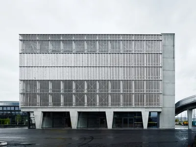
Hosoya Schaefer Architects Build a Timber-Clad Mobility Hub as Zug's Gateway to a Smart City District
A parking structure, retail hub, and pedestrian bridge in Zug, Switzerland, designed to evolve alongside autonomous vehicle technology.

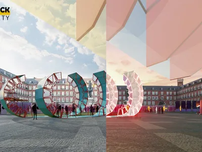
Instant City: Archigram's Roaming Metropolis Rebuilt as a Fleet of Unfolding Cultural Modules
A fleet of autonomous modules unfolds from compact transport forms into stages, markets and cinemas, turning plazas into temporary cultural venues.

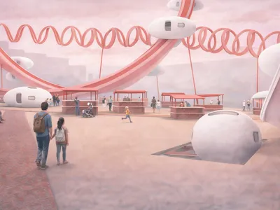
The “ Spine ”
From transportation to inhabitation - reimagining movement as a way of living.

Transitional Linkage: An Elevated Pedestrian Spine That Formalizes a City's Most Dangerous Shortcut
Zillur Rahman turns an informal crossing over rail and highway into a raised civic spine that ties six transport modes together at a single shared level.


