
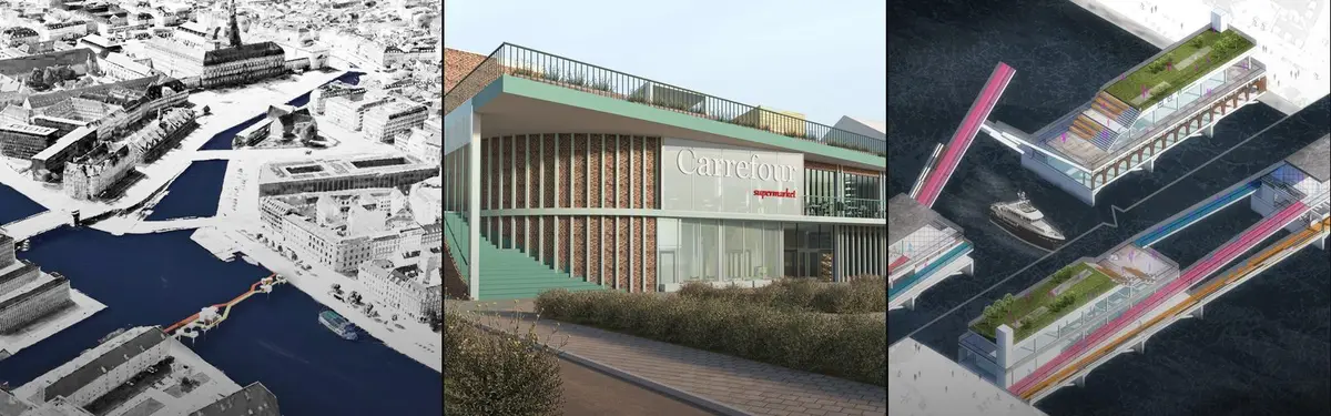


Walkable City
Design approaches to creating cities that prioritize pedestrian movement, cycling, and accessible public spaces.
A walkable city is a city where most of what people need each day, from shops and schools to work, parks and transit, is within a comfortable walk along streets that feel safe, interesting and pleasant to use. Its tools are low-tech and physical: density, mixed uses, short blocks, safe crossings, shade and places to sit.
What is a walkable city?
Walkability describes how well the built environment supports walking as an everyday way to get around, not just as leisure. A walkable neighbourhood has enough people living and working close together to support local shops and frequent transit, a mix of uses so that errands can be chained on foot, and a fine grain of streets that offers many short, direct routes. Just as important is the quality of the walk itself: crossings that put pedestrians first, slow traffic, continuous pavements, trees for shade and benches to rest on.
Walkable city design overlaps with pedestrian zones, but it is broader. A car-free shopping street can sit in a city that is otherwise impossible to walk, while a walkable city may keep cars on most streets and simply make them slower, narrower and safer. The detail of benches, kiosks and shelters, and the observational work of William H. Whyte and Jan Gehl on how people use them, is covered in our article on street furniture.
It also differs sharply from the smart city. A smart city relies on sensors, data and connected infrastructure to manage services. A walkable city needs none of that. Its success depends on the shape of blocks and streets, which can last for centuries without an upgrade. The two can support each other, but a city can be highly walkable with no digital systems at all, and a heavily instrumented city can still be miserable on foot.
A short history of the walkable city
For most of history every city was walkable by necessity. The modern idea of walkability emerged as a reaction to the car-oriented planning of the mid twentieth century. Its foundational text is Jane Jacobs's 1961 book The Death and Life of Great American Cities. Jacobs opposed large urban renewal schemes and freeways through inner cities, and argued instead for dense, mixed-use districts and walkable streets watched by the "eyes on the street" of passers-by. She named four generators of diversity: mixed primary uses, short blocks, buildings of various ages and density.
"Great cities are not like towns, only larger. They are not like suburbs, only denser. They differ from towns and suburbs in basic ways, and one of them is that cities are, by definition, full of strangers."
Jane Jacobs, The Death and Life of Great American Cities (1961), as collected on Wikiquote
Europe was already experimenting. Copenhagen turned Strøget into a pedestrian zone on 17 November 1962, at a time when cars were beginning to dominate the old centre. Many merchants feared they would lose business. Instead the street thrived, and the car-free network was extended in 1968, 1973 and 1992, growing from 15,800 square metres to about 100,000 square metres.

Smaller cities have gone further. Pontevedra in Galicia began pedestrianising its old town in 1999, then extended the approach to the city centre. In 2010 it became the first provincial capital in Spain to cut the speed limit in its centre to 30 kilometres per hour, and in 2019 lowered it to 10 kilometres per hour there, alongside a pedestrian plan called Metrominuto.

In 2012 the American planner Jeff Speck published Walkable City: How Downtown Can Save America, One Step at a Time. Its first part sets out his "General Theory of Walkability" and the second a ten-step process for making cities walkable; it became the best-selling city-planning book of 2013 and 2014. Four years later Carlos Moreno introduced the 15-minute city in a 2016 opinion piece, and the idea spread after Paris mayor Anne Hidalgo made it part of her 2020 re-election campaign. Moreno received the UN-Habitat Scroll of Honour in 2022 as the concept's creator, according to his own site.
Key principles of walkable city design
Density and proximity
Walking only works when destinations are close. The 15-minute city frames this as time: for walking, a 15-minute radius corresponds roughly to one kilometre. Enough homes inside that radius make local shops, clinics and frequent buses viable, which in turn gives people a reason to walk.
Mixed use
Single-use zoning spreads daily life across distances that only a car can cover. City Center, Indore, a thesis by Keshav Rathi, argues the opposite: gather a market, a cultural plaza with an amphitheatre, a library, offices and a hotel onto one site and tie them together with a street spine that is treated as a programme in its own right.

Short blocks and direct routes
Jacobs's case for short blocks is about choice: more corners mean more routes, more frontage and more chances to meet. Pedestrians also vote with their feet. Transitional Linkage by Zillur Rahman starts from an informal shortcut that people take across a railway and a highway, and instead of fencing it off builds an elevated pedestrian spine along that desire line, linking several transport modes at one level.
Safe crossings and slow traffic
Speed decides whether a street is walkable. Pontevedra's 30 and then 10 kilometre per hour limits show how much can be achieved with signs, paving and enforcement rather than new structures. Where roads and rail are too large to slow down, a well-designed crossing has to bring people over them directly.

Shade and places to sit
People walk further when they can rest and stay cool. Health & The City by Parin Visariya, Sanya Gupta, Trishala Konnure and Tejashree Kulkarni proposes a modular furniture system for Mumbai's footpaths that adds exercise, hydration and rest to the street.
"if people already walk, pause, and gather on footpaths, why not design those surfaces to actively improve their health?"
UNI journal, Health & The City

Continuous networks
A walkable city is a network, not a collection of nice streets. Rivers, rail lines and highways break that network, which is why so much member work focuses on bridges and crossings that do more than carry people across.
Walkable city projects on uni.xyz
uni.xyz members approach walkability from transit stations, footpaths, bridges and whole neighbourhoods, often in Indian cities where walking is already the main way people move.
Locals with Locality by Nidhi Piludaria, Reema Prajapati, Krutik Patel, Parag Mistry and Aalisha Sorathiya is the most liked project in this topic and received a People's Choice Award in the Hyperlocal competition. It uses pedestrianisation, multiple levels of network and transit oriented development to relieve the crowding around Mumbai's local train system by 2030.
PULIYA by Saheel Birewar, made for the Parasitic Architecture 2020 competition, looks at dense, congested urban cores such as the city of Chandrapur and treats transit infrastructure like bridges as places for public life, aiming to make these areas more livable and inclusive.

Meet-in-the-Middle by B.N.P MARS and Duval Annabelle proposes a pedestrian-first mobility network for Mumbai, a city where, as the journal notes, fifteen million walking trips are made every day. It layers aerial connectors, green elevated corridors and a metropolitan hub, starting with dense areas such as Dharavi, Andheri and Vile Parle.
Cities for Every Generation by Heba Rasheed is a planning thesis on family-friendly cities, using Kochi in Kerala as its study area. It proposes a framework built on walkable neighbourhoods, child-friendly public spaces, universal accessibility and mixed-use development, with particular attention to children, older adults, caregivers and persons with disabilities.
Lines of the Land by Shaedon Wedel, from the Street City Vietnam competition, combines an urban fish market with an arching greenway bridge above it, drawing on the terraced forms of Vietnamese fields and on local street vendors.

Copenhagen, whose pedestrian streets date back to 1962, is the setting for many member bridge proposals, several of them made for The City Link competition. Copenhagen Link, the "G" Pedestrian and Bicycle Bridge by Manuel Andres Rubiano, Johana Velasquez and Hernán Ferradás, sorts users by speed: cyclists ride the upper decks with the views and amenities, while pedestrians who simply want to cross take a direct route below. Matthew Zech's Urban Stitch makes the social argument for such crossings plainly.
"This city link acts as an urban stitch by pulling together both sides of the divide and creating a public space."
Matthew Zech, project statement for Urban Stitch (The City Link)
At street level, Kal | Aaj | Kal by Umar Sameer, an entry in the Neo Delhi competition, reimagines Connaught Place for the next century around six themes including accessibility, while re-grouping by Shannon McLain and Petra Stanev, from the Urbanscape: Symbiosis competition, proposes modular street furniture for Philadelphia that claims vacant lots and neglected infrastructure as public space.
Challenges and future directions
The hardest problem is the existing city. Much of the urban growth of the twentieth century was planned around the car, with long blocks, separated uses and wide roads, and these patterns are slow and expensive to change. Retrofitting usually means taking space from vehicles, which is politically difficult. Strøget's merchants opposed the first closure in 1962, and in 2023 conspiracy theories began to circulate describing 15-minute cities as instruments of government repression and a pretext to restrict car travel.
Barcelona offers one answer at the scale of a whole grid. Its Superblocks programme is becoming the street transformation model for the entire city, reclaiming space occupied by private vehicles to create a healthier, greener and safer public realm. The city council's plan focuses on the Eixample, turning streets into green hubs where pedestrians have priority and creating four squares of around 2,000 m² at their junctions.

Future work will need to combine walkability with climate adaptation, since shade, trees and water on the street matter more each summer, and with fairness, so that calmer, greener streets are not only found in wealthy districts.
Walkable city design for students and designers
Walkability makes an excellent thesis subject because it can be studied with a notebook and a pair of shoes. Walk a district at different times of day and map desire lines, missing crossings, shade and places to sit, then design the smallest interventions that would change how people move. Other angles include a 15-minute audit of your own neighbourhood, the retrofit of a station area, or a temporary trial borrowed from tactical urbanism. Compare your proposal with a high-tech smart city approach to the same street, look at urban mobility work for networks, and test ideas in uni.xyz competitions.
Frequently asked questions
What makes a city walkable?
Density, a mix of uses, short blocks and connected streets put destinations within reach. Safe crossings, slow traffic, shade and places to sit make the walk itself pleasant enough that people choose it.
Who wrote Walkable City?
The American planner Jeff Speck. Walkable City: How Downtown Can Save America, One Step at a Time was published in 2012 and sets out his General Theory of Walkability.
What is the 15-minute city?
It is a planning concept introduced by Carlos Moreno in 2016, in which residents can reach their daily needs within a 15-minute walk or bike ride. It gained wide attention after Paris mayor Anne Hidalgo adopted it in her 2020 campaign.
Which cities are good examples of walkability?
Pontevedra in Spain, which pedestrianised its centre from 1999, and Copenhagen, whose Strøget has been car-free since 1962, are two frequently studied examples. Barcelona's superblocks show how an existing grid can be adapted.
How is a walkable city different from a smart city?
A walkable city depends on physical design, not technology. A smart city uses sensors and data to manage services. A city can be walkable without any digital systems.
References and further reading
- The Death and Life of Great American Cities, Wikipedia
- Jane Jacobs, Wikiquote
- Jeff Speck, Wikipedia
- 15-minute city, Wikipedia
- Carlos Moreno: Human scale city, Carlos Moreno
- Strøget, Wikipedia
- Pontevedra, Wikipedia
- Superilles (Superblocks), Barcelona City Council


Popular projects
View all 34 projects


Latest journals
View all 43 journals
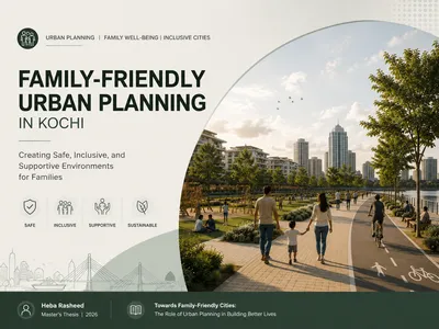
Cities for Every Generation
Planning Kochi for Safer, Inclusive, and Family-Friendly Urban Living By Heba Rasheed

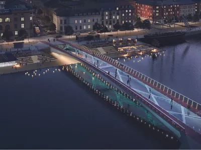
The City Hub: A Copenhagen Bascule Bridge That Anchors a Floating Public Platform Beneath Its Span
A cycling bridge with two 50-metre bascule leaves and a two-level floating platform turns a Copenhagen canal crossing into a place to stay.
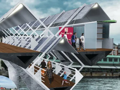
Copenhagen Link: A Pedestrian and Bicycle Bridge That Splits Its Users Across Three Solar-Powered Paths
Three 100-metre paths, 540 solar panels and self-cleaning concrete turn a river crossing into a place to pause, recharge and drink coffee.

The Shelter: A Copenhagen Bridge That Stacks Cyclists, Pedestrians and a Bird Sanctuary
Eve C's harbour crossing nests cycle lanes, an elevated promenade, civic programmes and a 15-metre planted tower for birds into one curving structure.


